Santa Rosa de Lima geodata
Santa Rosa de Lima (Querétaro) is a populated place; located in Mexico in America/Mexico_City (GMT-6) time zone. With population of 1,700 people, there are 5110 cities with bigger population in this country. Compared to other cities in Mexico, 71.2% of cities are located further ↓South; 63.7% of cities are located further →East and 70.9% of cities have lower elevation than Santa Rosa de Lima. Note1


Santa Rosa de Lima GPS coordinates[2]
20° 39' 56.34" North, 99° 58' 42.636" West
| Map corner | latitude | longitude |
|---|---|---|
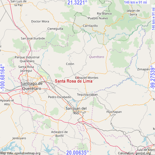
| Upper-left | 21.3221°, | -100.68164° |
| Center: | 20.66565°, | -99.97851° |
| Lower-right: | 20.00635°, | -99.27539° |
| Map W x H: | 146.3×146.3 km | = 90.9×90.9mi |
| max Lat: | 32.7° ⇑28.8% North |
| Santa Rosa de Lima: | 20.66565° |
| min Lat: | ⇓71.2% South 14.53588° |
| min Long | Santa Rosa de L | max Long |
| -117.105° | -99.97851° | -86.73105° |
| W 36.3%⇐ | ⇒63.7% E |
Elevation
Elevation of Santa Rosa de Lima is 1944 m = 6378 ft, and this is 690.3 m = 2265 ft above average elevation for this country.
| Max E: |
3497 m = 11473 ft | 29.1% |
| Santa Rosa de Lima | 1944 m 6378 ft | |
| Avg. | 1253.7 m = 4113 ft | |
Min E: |
-1 m = -3 ft | 70.9% |
See also: Mexico elevation on elevation.city.
Geographical zone
Santa Rosa de Lima is located in North Torrid zone (between Equator and Tropic of Cancer). Distance of this Northern Tropic circle is 308.1 km =191.4 mi to North.| Distance of | km | miles | from Santa Rosa de Lima |
|---|---|---|---|
| North Pole | 7709.3 | 4790.3 | to North |
| Arctic Circle | 5103.4 | 3171.1 | to North |
| Tropic Cancer | 308.1 | 191.4 | to North |
| Equator | 2297.8 | 1427.8 | to South |


Nearby cities:
15 places around Santa Rosa de Lima: (largest is in red/bold)
• Ajuchitlán
6.3 km =3.9 mi,  316°
316°
• Bernal
9.2 km =5.7 mi,  25°
25°
• El Gallo
7.1 km =4.4 mi,  273°
273°
• El Jagüey Grande
9.9 km =6.2 mi,  43°
43°
• El Tejocote
7.7 km =4.8 mi,  228°
228°
• Ezequiel Montes
8.2 km =5.1 mi,  90°
90°
• La Providencia (Las Norbertas)
9.6 km =6 mi,  95°
95°
• La Purísima
6.8 km =4.2 mi,  81°
81°
• Los Benitos
3.2 km =2 mi,  47°
47°
• San José de la Laja
5.3 km =3.3 mi,  176°
176°
• San José del Jagüey
9.7 km =6 mi, 35°
• San Martín
6.4 km =4 mi,  3°
3°
• Santa Rosa Finca
1.3 km =0.8 mi,  74°
74°
• Santillán
8.3 km =5.2 mi,  150°
150°
• Urecho
10 km =6.2 mi,  262°
262°
Sources, notices
• [Note1] Compared only with cities in Mexico existing in our database
• [Src1] Map data: © OpenStreetMap contributors (CC-BY-SA)
• [Src2] Other city data from geonames.org with taken over terms of usage.
• [Src3] Geographical zone / Annual Mean Temperature by Robert A. Rohde @ Wikipedia
