Ayotzinapa geodata
Ayotzinapa (Guerrero) is a populated place; located in Mexico in America/Mexico_City (GMT-6) time zone. With population of 1,693 people, there are 5131 cities with bigger population in this country. Compared to other cities in Mexico, 82.5% of cities are located further ↑North; 54.2% of cities are located further ←West and 55.3% of cities have lower elevation than Ayotzinapa. Note1


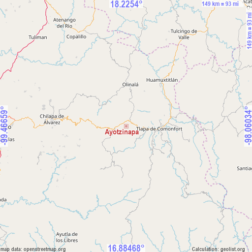
Ayotzinapa GPS coordinates[2]
17° 33' 22.608" North, 98° 45' 48.456" West
| Map corner | latitude | longitude |
|---|---|---|
| Upper-left | 18.2254°, | -99.46659° |
| Center: | 17.55628°, | -98.76346° |
| Lower-right: | 16.88468°, | -98.06034° |
| Map W x H: | 149.1×149.1 km | = 92.6×92.6mi |
| max Lat: | 32.7° ⇑82.5% North |
| Ayotzinapa: | 17.55628° |
| min Lat: | ⇓17.5% South 14.53588° |
| min Long | Ayotzinapa | max Long |
| -117.105° | -98.76346° | -86.73105° |
| W 54.2%⇐ | ⇒45.8% E |
Elevation
Elevation of Ayotzinapa is 1598 m = 5243 ft, and this is 344.3 m = 1130 ft above average elevation for this country.
| Max E: |
3497 m = 11473 ft | 44.7% |
| Ayotzinapa | 1598 m 5243 ft | |
| Avg. | 1253.7 m = 4113 ft | |
Min E: |
-1 m = -3 ft | 55.3% |
See also: Mexico elevation on elevation.city.
Geographical zone
Ayotzinapa is located in North Torrid zone (between Equator and Tropic of Cancer). Distance of this Northern Tropic circle is 653.8 km =406.3 mi to North.| Distance of | km | miles | from Ayotzinapa |
|---|---|---|---|
| North Pole | 8055 | 5005.1 | to North |
| Arctic Circle | 5449.1 | 3385.9 | to North |
| Tropic Cancer | 653.8 | 406.3 | to North |
| Equator | 1952.1 | 1213 | to South |


Nearby cities:
15 places around Ayotzinapa: (largest is in red/bold)
• Aquilpa
6 km =3.7 mi,  103°
103°
• Atlamajalcingo del Río
11.9 km =7.4 mi,  106°
106°
• Cacahuatepec
3.4 km =2.1 mi,  185°
185°
• Chiepetepec
3.3 km =2.1 mi,  71°
71°
• Coachimalco
11.6 km =7.2 mi,  48°
48°
• Copanatoyac
11.6 km =7.2 mi,  152°
152°
• Ocotequila
15 km =9.3 mi,  142°
142°
• Oztocingo
11.6 km =7.2 mi,  129°
129°
• Patlicha
13.7 km =8.5 mi,  161°
161°
• San Miguel Axoxuca
10.8 km =6.7 mi,  94°
94°
• San Pedro Petlacala
9.8 km =6.1 mi, 72°
• Tenango Tepexi
14.6 km =9.1 mi, 66°
• Tlalquetzalapa
7.8 km =4.8 mi, 144°
• Tlatlauquitepec
6.8 km =4.2 mi,  262°
262°
• Zapotitlán Tablas
14.8 km =9.2 mi, 187°
Sources, notices
• [Note1] Compared only with cities in Mexico existing in our database
• [Src1] Map data: © OpenStreetMap contributors (CC-BY-SA)
• [Src2] Other city data from geonames.org with taken over terms of usage.
• [Src3] Geographical zone / Annual Mean Temperature by Robert A. Rohde @ Wikipedia
