San Juan Coyula geodata
San Juan Coyula (Oaxaca) is a populated place; located in Mexico in America/Mexico_City (GMT-6) time zone. With population of 719 people, there are 12132 cities with bigger population in this country. Compared to other cities in Mexico, 79.6% of cities are located further ↑North; 76% of cities are located further ←West and 52.9% of cities have higher elevation than San Juan Coyula. Note1


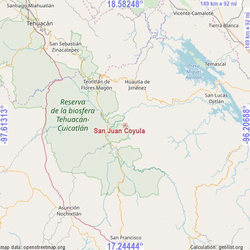
San Juan Coyula GPS coordinates[2]
17° 54' 52.992" North, 96° 54' 36" West
| Map corner | latitude | longitude |
|---|---|---|
| Upper-left | 18.58248°, | -97.61313° |
| Center: | 17.91472°, | -96.91° |
| Lower-right: | 17.24444°, | -96.20688° |
| Map W x H: | 148.8×148.8 km | = 92.5×92.5mi |
| max Lat: | 32.7° ⇑79.6% North |
| San Juan Coyula: | 17.91472° |
| min Lat: | ⇓20.4% South 14.53588° |
| min Long | San Juan Coyula | max Long |
| -117.105° | -96.91° | -86.73105° |
| W 76%⇐ | ⇒24% E |
Elevation
Elevation of San Juan Coyula is 1295 m = 4249 ft, and this is 41.3 m = 135 ft above average elevation for this country.
| Max E: |
3497 m = 11473 ft | 52.9% |
| San Juan Coyula | 1295 m 4249 ft | |
| Avg. | 1253.7 m = 4113 ft | |
Min E: |
-1 m = -3 ft | 47.1% |
See also: Mexico elevation on elevation.city.
Geographical zone
San Juan Coyula is located in North Torrid zone (between Equator and Tropic of Cancer). Distance of this Northern Tropic circle is 614 km =381.5 mi to North.| Distance of | km | miles | from San Juan Coyula |
|---|---|---|---|
| North Pole | 8015.1 | 4980.4 | to North |
| Arctic Circle | 5409.2 | 3361.1 | to North |
| Tropic Cancer | 614 | 381.5 | to North |
| Equator | 1991.9 | 1237.7 | to South |


Nearby cities:
15 places around San Juan Coyula: (largest is in red/bold)
• Aguacatitla
14.4 km =8.9 mi,  22°
22°
• Concepción Pápalo
8.6 km =5.3 mi,  159°
159°
• Cueyamecalco Villa de Zaragoza
10 km =6.2 mi,  55°
55°
• Cuicatlan
13.5 km =8.4 mi,  202°
202°
• Mazatlán Villa de Flores
13.1 km =8.1 mi,  358°
358°
• San Isidro Buenos Aires
7.7 km =4.8 mi, 57°
• San Lorenzo Pápalo
4.6 km =2.9 mi,  136°
136°
• San Miguel Santa Flor
11.7 km =7.3 mi,  86°
86°
• San Pedro Chicozapotes
17 km =10.6 mi, 197°
• Santa Ana Cuauhtémoc
14.4 km =8.9 mi, 57°
• Santa María Tlalixtac
18.7 km =11.6 mi,  78°
78°
• Santos Reyes Pápalo
13.2 km =8.2 mi, 157°
• Tecomavaca
12.8 km =8 mi,  290°
290°
• Tomellín
18.1 km =11.2 mi, 197°
• Valerio Trujano
17.5 km =10.9 mi,  205°
205°
Sources, notices
• [Note1] Compared only with cities in Mexico existing in our database
• [Src1] Map data: © OpenStreetMap contributors (CC-BY-SA)
• [Src2] Other city data from geonames.org with taken over terms of usage.
• [Src3] Geographical zone / Annual Mean Temperature by Robert A. Rohde @ Wikipedia
