Aguacatitla geodata
Aguacatitla (Oaxaca) is a populated place; located in Mexico in America/Mexico_City (GMT-6) time zone. With population of 889 people, there are 9811 cities with bigger population in this country. Compared to other cities in Mexico, 78.2% of cities are located further ↑North; 76.6% of cities are located further ←West and 58.4% of cities have higher elevation than Aguacatitla. Note1


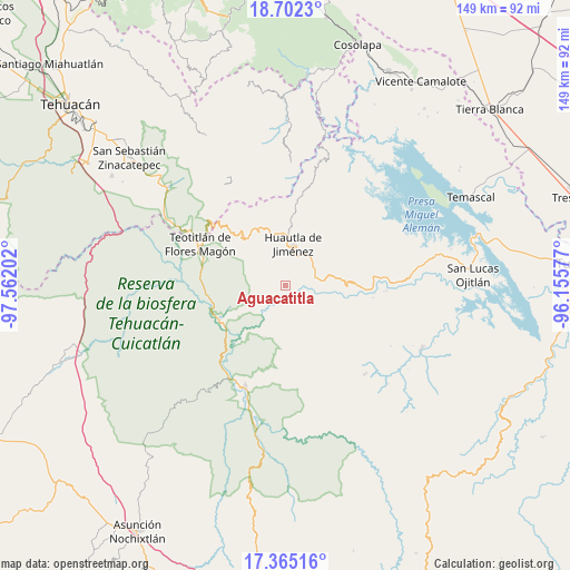
Aguacatitla GPS coordinates[2]
18° 2' 6" North, 96° 51' 32.004" West
| Map corner | latitude | longitude |
|---|---|---|
| Upper-left | 18.7023°, | -97.56202° |
| Center: | 18.035°, | -96.85889° |
| Lower-right: | 17.36516°, | -96.15577° |
| Map W x H: | 148.7×148.7 km | = 92.4×92.4mi |
| max Lat: | 32.7° ⇑78.2% North |
| Aguacatitla: | 18.035° |
| min Lat: | ⇓21.8% South 14.53588° |
| min Long | Aguacatitla | max Long |
| -117.105° | -96.85889° | -86.73105° |
| W 76.6%⇐ | ⇒23.4% E |
Elevation
Elevation of Aguacatitla is 1086 m = 3563 ft, and this is 167.7 m = 550 ft below average elevation for this country.
| Max E: |
3497 m = 11473 ft | 58.4% |
| Avg. | 1253.7 m = 4113 ft | |
| Aguacatitla | 1086 m = 3563 ft | |
Min E: |
-1 m = -3 ft | 41.6% |
See also: Mexico elevation on elevation.city.
Geographical zone
Aguacatitla is located in North Torrid zone (between Equator and Tropic of Cancer). Distance of this Northern Tropic circle is 600.6 km =373.2 mi to North.| Distance of | km | miles | from Aguacatitla |
|---|---|---|---|
| North Pole | 8001.8 | 4972.1 | to North |
| Arctic Circle | 5395.9 | 3352.9 | to North |
| Tropic Cancer | 600.6 | 373.2 | to North |
| Equator | 2005.3 | 1246 | to South |


Nearby cities:
15 places around Aguacatitla: (largest is in red/bold)
• Cueyamecalco Villa de Zaragoza
8.2 km =5.1 mi,  159°
159°
• El Camarón
6.9 km =4.3 mi,  61°
61°
• El Carrizal
7.6 km =4.7 mi,  0°
0°
• Huautepec
9.9 km =6.2 mi,  42°
42°
• Llano de Agua
9.4 km =5.8 mi,  32°
32°
• Loma Chapultepec
9.6 km =6 mi,  12°
12°
• Mazatlán Villa de Flores
5.8 km =3.6 mi,  267°
267°
• San Isidro
10.6 km =6.6 mi,  84°
84°
• San Isidro Buenos Aires
9.3 km =5.8 mi,  173°
173°
• San Isidro Zoquiápam
9.9 km =6.2 mi,  314°
314°
• San Juan Coatzospam
10.3 km =6.4 mi, 80°
• Santa Ana Cuauhtémoc
8.8 km =5.5 mi,  129°
129°
• Santa Catarina Buenavista
7.4 km =4.6 mi,  51°
51°
• Santa María la Asunción
9.1 km =5.7 mi, 27°
• Xochitonalco
6.7 km =4.2 mi, 9°
Sources, notices
• [Note1] Compared only with cities in Mexico existing in our database
• [Src1] Map data: © OpenStreetMap contributors (CC-BY-SA)
• [Src2] Other city data from geonames.org with taken over terms of usage.
• [Src3] Geographical zone / Annual Mean Temperature by Robert A. Rohde @ Wikipedia
