El Guamúchil geodata
El Guamúchil (Guanajuato) is a populated place; located in Mexico in America/Mexico_City (GMT-6) time zone. With population of 584 people, there are 14684 cities with bigger population in this country. Compared to other cities in Mexico, 80.2% of cities are located further ↓South; 63.2% of cities are located further →East and 61.1% of cities have higher elevation than El Guamúchil. Note1


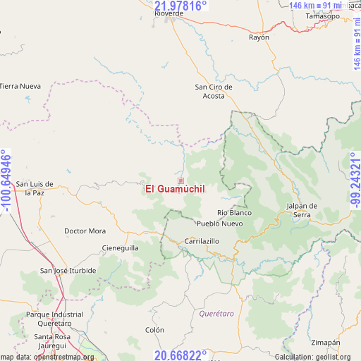
El Guamúchil GPS coordinates[2]
21° 19' 28.74" North, 99° 56' 46.788" West
| Map corner | latitude | longitude |
|---|---|---|
| Upper-left | 21.97816°, | -100.64946° |
| Center: | 21.32465°, | -99.94633° |
| Lower-right: | 20.66822°, | -99.24321° |
| Map W x H: | 145.7×145.7 km | = 90.5×90.5mi |
| max Lat: | 32.7° ⇑19.8% North |
| El Guamúchil: | 21.32465° |
| min Lat: | ⇓80.2% South 14.53588° |
| min Long | El Guamúchil | max Long |
| -117.105° | -99.94633° | -86.73105° |
| W 36.8%⇐ | ⇒63.2% E |
Elevation
Elevation of El Guamúchil is 932 m = 3058 ft, and this is 321.7 m = 1055 ft below average elevation for this country.
| Max E: |
3497 m = 11473 ft | 61.1% |
| Avg. | 1253.7 m = 4113 ft | |
| El Guamúchil | 932 m = 3058 ft | |
Min E: |
-1 m = -3 ft | 38.9% |
See also: Mexico elevation on elevation.city.
Geographical zone
El Guamúchil is located in North Torrid zone (between Equator and Tropic of Cancer). Distance of this Northern Tropic circle is 234.8 km =145.9 mi to North.| Distance of | km | miles | from El Guamúchil |
|---|---|---|---|
| North Pole | 7636 | 4744.8 | to North |
| Arctic Circle | 5030.1 | 3125.6 | to North |
| Tropic Cancer | 234.8 | 145.9 | to North |
| Equator | 2371.1 | 1473.3 | to South |


Nearby cities:
15 places around El Guamúchil: (largest is in red/bold)
• Agua Fría
24 km =14.9 mi,  142°
142°
• Atarjea
24.4 km =15.2 mi,  105°
105°
• Camargo
32.9 km =20.4 mi, 137°
• El Carricillo
11.8 km =7.3 mi,  94°
94°
• Fracción de Guadalupe
30.4 km =18.9 mi,  224°
224°
• Los Linderos
31.9 km =19.8 mi,  249°
249°
• Los Remedios
30.5 km =19 mi,  239°
239°
• Milpillas de Santiago
27.7 km =17.2 mi, 240°
• Palmillas
30.9 km =19.2 mi, 251°
• Peñamiller
33 km =20.5 mi,  155°
155°
• San Miguel Palmas
25.1 km =15.6 mi,  184°
184°
• Santa Catarina
24 km =14.9 mi,  212°
212°
• Tasajillo
29.5 km =18.3 mi, 245°
• Victoria
30.6 km =19 mi, 245°
• Xichú
11.8 km =7.3 mi,  256°
256°
Sources, notices
• [Note1] Compared only with cities in Mexico existing in our database
• [Src1] Map data: © OpenStreetMap contributors (CC-BY-SA)
• [Src2] Other city data from geonames.org with taken over terms of usage.
• [Src3] Geographical zone / Annual Mean Temperature by Robert A. Rohde @ Wikipedia
