El Carricillo geodata
El Carricillo (Guanajuato) is a populated place; located in Mexico in America/Mexico_City (GMT-6) time zone. With population of 702 people, there are 12396 cities with bigger population in this country. Compared to other cities in Mexico, 80.1% of cities are located further ↓South; 61.9% of cities are located further →East and 79% of cities have lower elevation than El Carricillo. Note1


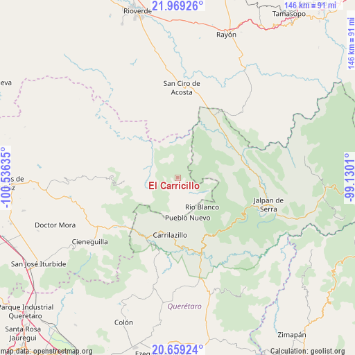
El Carricillo GPS coordinates[2]
21° 18' 56.556" North, 99° 49' 59.592" West
| Map corner | latitude | longitude |
|---|---|---|
| Upper-left | 21.96926°, | -100.53635° |
| Center: | 21.31571°, | -99.83322° |
| Lower-right: | 20.65924°, | -99.1301° |
| Map W x H: | 145.7×145.7 km | = 90.5×90.5mi |
| max Lat: | 32.7° ⇑19.9% North |
| El Carricillo: | 21.31571° |
| min Lat: | ⇓80.1% South 14.53588° |
| min Long | El Carricillo | max Long |
| -117.105° | -99.83322° | -86.73105° |
| W 38.1%⇐ | ⇒61.9% E |
Elevation
Elevation of El Carricillo is 2115 m = 6939 ft, and this is 861.3 m = 2826 ft above average elevation for this country.
| Max E: |
3497 m = 11473 ft | 21% |
| El Carricillo | 2115 m 6939 ft | |
| Avg. | 1253.7 m = 4113 ft | |
Min E: |
-1 m = -3 ft | 79% |
See also: Mexico elevation on elevation.city.
Geographical zone
El Carricillo is located in North Torrid zone (between Equator and Tropic of Cancer). Distance of this Northern Tropic circle is 235.8 km =146.5 mi to North.| Distance of | km | miles | from El Carricillo |
|---|---|---|---|
| North Pole | 7637 | 4745.4 | to North |
| Arctic Circle | 5031.1 | 3126.2 | to North |
| Tropic Cancer | 235.8 | 146.5 | to North |
| Equator | 2370.1 | 1472.7 | to South |


Nearby cities:
15 places around El Carricillo: (largest is in red/bold)
• Agua Fría
18.3 km =11.4 mi,  171°
171°
• Ahuacatlán de Guadalupe
32.3 km =20.1 mi,  110°
110°
• Arroyo Seco
29.8 km =18.5 mi,  30°
30°
• Atarjea
13 km =8.1 mi, 114°
• Camargo
25.6 km =15.9 mi,  156°
156°
• Concá
25 km =15.5 mi,  54°
54°
• El Guamúchil
11.8 km =7.3 mi,  274°
274°
• Peña Blanca
32.5 km =20.2 mi, 161°
• Peñamiller
29.1 km =18.1 mi,  176°
176°
• Pinal de Amoles
29.5 km =18.3 mi,  133°
133°
• San Miguel Palmas
27.7 km =17.2 mi,  209°
209°
• Santa Catarina
31.2 km =19.4 mi,  231°
231°
• Sauz de Guadalupe
24.8 km =15.4 mi, 110°
• Villa Emiliano Zapata (Extoraz)
31.9 km =19.8 mi, 169°
• Xichú
23.3 km =14.5 mi, 265°
Sources, notices
• [Note1] Compared only with cities in Mexico existing in our database
• [Src1] Map data: © OpenStreetMap contributors (CC-BY-SA)
• [Src2] Other city data from geonames.org with taken over terms of usage.
• [Src3] Geographical zone / Annual Mean Temperature by Robert A. Rohde @ Wikipedia
