Xichú geodata
Xichú (Guanajuato) is a seat of a second-order administrative division; located in Mexico in America/Mexico_City (GMT-6) time zone. With population of 1,569 people, there are 5502 cities with bigger population in this country. Compared to other cities in Mexico, 80% of cities are located further ↓South; 64.7% of cities are located further →East and 52.5% of cities have higher elevation than Xichú. Note1


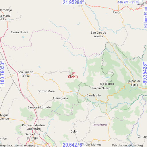
Xichú GPS coordinates[2]
21° 17' 57.516" North, 100° 3' 26.64" West
| Map corner | latitude | longitude |
|---|---|---|
| Upper-left | 21.95294°, | -100.76053° |
| Center: | 21.29931°, | -100.0574° |
| Lower-right: | 20.64276°, | -99.35428° |
| Map W x H: | 145.7×145.7 km | = 90.5×90.5mi |
| max Lat: | 32.7° ⇑20% North |
| Xichú: | 21.29931° |
| min Lat: | ⇓80% South 14.53588° |
| min Long | Xichú | max Long |
| -117.105° | -100.0574° | -86.73105° |
| W 35.3%⇐ | ⇒64.7% E |
Elevation
Elevation of Xichú is 1317 m = 4321 ft, and this is 63.3 m = 208 ft above average elevation for this country.
| Max E: |
3497 m = 11473 ft | 52.5% |
| Xichú | 1317 m 4321 ft | |
| Avg. | 1253.7 m = 4113 ft | |
Min E: |
-1 m = -3 ft | 47.5% |
See also: Mexico elevation on elevation.city.
Geographical zone
Xichú is located in North Torrid zone (between Equator and Tropic of Cancer). Distance of this Northern Tropic circle is 237.7 km =147.7 mi to North.| Distance of | km | miles | from Xichú |
|---|---|---|---|
| North Pole | 7638.8 | 4746.5 | to North |
| Arctic Circle | 5032.9 | 3127.3 | to North |
| Tropic Cancer | 237.7 | 147.7 | to North |
| Equator | 2368.3 | 1471.6 | to South |


Nearby cities:
15 places around Xichú: (largest is in red/bold)
• Cieneguilla
23.1 km =14.4 mi,  255°
255°
• El Carricillo
23.3 km =14.5 mi,  85°
85°
• El Guamúchil
11.8 km =7.3 mi,  76°
76°
• Fracción de Guadalupe
21.2 km =13.2 mi,  207°
207°
• Las Moras
27.4 km =17 mi,  203°
203°
• Los Linderos
20.2 km =12.6 mi,  245°
245°
• Los Remedios
19.4 km =12.1 mi,  229°
229°
• Milpillas de Santiago
16.7 km =10.4 mi, 228°
• Misión de Arnedo
21.6 km =13.4 mi, 249°
• Palmillas
19.1 km =11.9 mi, 248°
• San Miguel Palmas
24.2 km =15 mi,  156°
156°
• Santa Catarina
17.6 km =10.9 mi,  184°
184°
• Tasajillo
18 km =11.2 mi,  238°
238°
• Tierra Blanca
24.5 km =15.2 mi, 205°
• Victoria
19 km =11.8 mi, 239°
Sources, notices
• [Note1] Compared only with cities in Mexico existing in our database
• [Src1] Map data: © OpenStreetMap contributors (CC-BY-SA)
• [Src2] Other city data from geonames.org with taken over terms of usage.
• [Src3] Geographical zone / Annual Mean Temperature by Robert A. Rohde @ Wikipedia
