Santiago Llano Grande geodata
Santiago Llano Grande (Oaxaca) is a populated place; located in Mexico in America/Mexico_City (GMT-6) time zone. With population of 1,880 people, there are 4629 cities with bigger population in this country. Compared to other cities in Mexico, 94.4% of cities are located further ↑North; 60% of cities are located further ←West and 81.4% of cities have higher elevation than Santiago Llano Grande. Note1


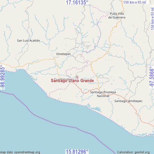
Santiago Llano Grande GPS coordinates[2]
16° 29' 17.988" North, 98° 17' 22.992" West
| Map corner | latitude | longitude |
|---|---|---|
| Upper-left | 17.16135°, | -98.99285° |
| Center: | 16.48833°, | -98.28972° |
| Lower-right: | 15.81296°, | -97.5866° |
| Map W x H: | 149.9×149.9 km | = 93.1×93.1mi |
| max Lat: | 32.7° ⇑94.4% North |
| Santiago Llano Grande: | 16.48833° |
| min Lat: | ⇓5.6% South 14.53588° |
| min Long | Santiago Llano | max Long |
| -117.105° | -98.28972° | -86.73105° |
| W 60%⇐ | ⇒40% E |
Elevation
Elevation of Santiago Llano Grande is 77 m = 253 ft, and this is 1176.7 m = 3861 ft below average elevation for this country.
| Max E: |
3497 m = 11473 ft | 81.4% |
| Avg. | 1253.7 m = 4113 ft | |
| Santiago Llano Grande | 77 m = 253 ft | |
Min E: |
-1 m = -3 ft | 18.6% |
See also: Mexico elevation on elevation.city.
Geographical zone
Santiago Llano Grande is located in North Torrid zone (between Equator and Tropic of Cancer). Distance of this Northern Tropic circle is 772.6 km =480.1 mi to North.| Distance of | km | miles | from Santiago Llano Grande |
|---|---|---|---|
| North Pole | 8173.7 | 5078.9 | to North |
| Arctic Circle | 5567.8 | 3459.7 | to North |
| Tropic Cancer | 772.6 | 480.1 | to North |
| Equator | 1833.3 | 1139.2 | to South |


Nearby cities:
15 places around Santiago Llano Grande: (largest is in red/bold)
• Cuajinicuilapa
13.3 km =8.3 mi,  262°
262°
• El Quiza
12.9 km =8 mi,  287°
287°
• El Terrero
17.9 km =11.1 mi,  297°
297°
• Huajintepec
14.9 km =9.3 mi,  25°
25°
• Lagunillas
17.3 km =10.7 mi,  155°
155°
• Mártires de Tacubaya
6.8 km =4.2 mi,  35°
35°
• Piedra Ancha
13.4 km =8.3 mi,  325°
325°
• Rancho Nuevo
7.7 km =4.8 mi,  129°
129°
• San Francisco del Maguey
2.9 km =1.8 mi, 327°
• San José Estancia Grande
14.3 km =8.9 mi, 163°
• San Juan Bautista Lo de Soto
6.7 km =4.2 mi, 293°
• San Sebastián Ixcapa
16.7 km =10.4 mi,  67°
67°
• Santa María Cortijo
4.1 km =2.5 mi,  173°
173°
• Tierra Blanca
14 km =8.7 mi,  345°
345°
• Vista Hermosa
13.2 km =8.2 mi, 66°
Sources, notices
• [Note1] Compared only with cities in Mexico existing in our database
• [Src1] Map data: © OpenStreetMap contributors (CC-BY-SA)
• [Src2] Other city data from geonames.org with taken over terms of usage.
• [Src3] Geographical zone / Annual Mean Temperature by Robert A. Rohde @ Wikipedia
