Rancho Nuevo geodata
Rancho Nuevo (Oaxaca) is a populated place; located in Mexico in America/Mexico_City (GMT-6) time zone. With population of 535 people, there are 15842 cities with bigger population in this country. Compared to other cities in Mexico, 94.7% of cities are located further ↑North; 60.7% of cities are located further ←West and 78.4% of cities have higher elevation than Rancho Nuevo. Note1


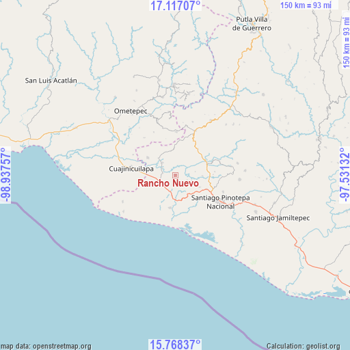
Rancho Nuevo GPS coordinates[2]
16° 26' 38.004" North, 98° 14' 3.984" West
| Map corner | latitude | longitude |
|---|---|---|
| Upper-left | 17.11707°, | -98.93757° |
| Center: | 16.44389°, | -98.23444° |
| Lower-right: | 15.76837°, | -97.53132° |
| Map W x H: | 150×150 km | = 93.2×93.2mi |
| max Lat: | 32.7° ⇑94.7% North |
| Rancho Nuevo: | 16.44389° |
| min Lat: | ⇓5.3% South 14.53588° |
| min Long | Rancho Nuevo | max Long |
| -117.105° | -98.23444° | -86.73105° |
| W 60.7%⇐ | ⇒39.3% E |
Elevation
Elevation of Rancho Nuevo is 122 m = 400 ft, and this is 1131.7 m = 3713 ft below average elevation for this country.
| Max E: |
3497 m = 11473 ft | 78.4% |
| Avg. | 1253.7 m = 4113 ft | |
| Rancho Nuevo | 122 m = 400 ft | |
Min E: |
-1 m = -3 ft | 21.6% |
See also: Mexico elevation on elevation.city.
Geographical zone
Rancho Nuevo is located in North Torrid zone (between Equator and Tropic of Cancer). Distance of this Northern Tropic circle is 777.5 km =483.1 mi to North.| Distance of | km | miles | from Rancho Nuevo |
|---|---|---|---|
| North Pole | 8178.7 | 5082 | to North |
| Arctic Circle | 5572.8 | 3462.8 | to North |
| Tropic Cancer | 777.5 | 483.1 | to North |
| Equator | 1828.4 | 1136.1 | to South |


Nearby cities:
15 places around Rancho Nuevo: (largest is in red/bold)
• Camotinchan
17.3 km =10.7 mi,  42°
42°
• El Ciruelo
14.2 km =8.8 mi,  189°
189°
• Huajintepec
18.5 km =11.5 mi,  1°
1°
• Lagunillas
10.8 km =6.7 mi,  173°
173°
• Lo de Candela
11.7 km =7.3 mi,  116°
116°
• Mancuernas
14.6 km =9.1 mi,  114°
114°
• Mártires de Tacubaya
10.7 km =6.6 mi,  349°
349°
• San Francisco del Maguey
10.5 km =6.5 mi,  314°
314°
• San José Estancia Grande
8.9 km =5.5 mi, 191°
• San Juan Bautista Lo de Soto
14.3 km =8.9 mi,  302°
302°
• San Sebastián Ixcapa
14.8 km =9.2 mi, 40°
• Santa María Cortijo
5.5 km =3.4 mi,  278°
278°
• Santiago Llano Grande
7.7 km =4.8 mi, 309°
• Vista Hermosa
12 km =7.5 mi,  31°
31°
• Yutandayoo
16.9 km =10.5 mi,  84°
84°
Sources, notices
• [Note1] Compared only with cities in Mexico existing in our database
• [Src1] Map data: © OpenStreetMap contributors (CC-BY-SA)
• [Src2] Other city data from geonames.org with taken over terms of usage.
• [Src3] Geographical zone / Annual Mean Temperature by Robert A. Rohde @ Wikipedia
