San Mateo Etlatongo geodata
San Mateo Etlatongo (Oaxaca) is a seat of a second-order administrative division; located in Mexico in America/Mexico_City (GMT-6) time zone. With population of 427 people, there are 16840 cities with bigger population in this country. Compared to other cities in Mexico, 84% of cities are located further ↑North; 71.7% of cities are located further ←West and 75.9% of cities have lower elevation than San Mateo Etlatongo. Note1


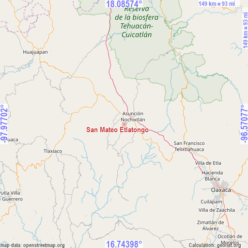
San Mateo Etlatongo GPS coordinates[2]
17° 24' 57.924" North, 97° 16' 26.004" West
| Map corner | latitude | longitude |
|---|---|---|
| Upper-left | 18.08574°, | -97.97702° |
| Center: | 17.41609°, | -97.27389° |
| Lower-right: | 16.74398°, | -96.57077° |
| Map W x H: | 149.2×149.2 km | = 92.7×92.7mi |
| max Lat: | 32.7° ⇑84% North |
| San Mateo Etlatongo: | 17.41609° |
| min Lat: | ⇓16% South 14.53588° |
| min Long | San Mateo Etlat | max Long |
| -117.105° | -97.27389° | -86.73105° |
| W 71.7%⇐ | ⇒28.3% E |
Elevation
Elevation of San Mateo Etlatongo is 2046 m = 6713 ft, and this is 792.3 m = 2599 ft above average elevation for this country.
| Max E: |
3497 m = 11473 ft | 24.1% |
| San Mateo Etlatongo | 2046 m 6713 ft | |
| Avg. | 1253.7 m = 4113 ft | |
Min E: |
-1 m = -3 ft | 75.9% |
See also: Mexico elevation on elevation.city.
Geographical zone
San Mateo Etlatongo is located in North Torrid zone (between Equator and Tropic of Cancer). Distance of this Northern Tropic circle is 669.4 km =415.9 mi to North.| Distance of | km | miles | from San Mateo Etlatongo |
|---|---|---|---|
| North Pole | 8070.6 | 5014.8 | to North |
| Arctic Circle | 5464.7 | 3395.6 | to North |
| Tropic Cancer | 669.4 | 415.9 | to North |
| Equator | 1936.5 | 1203.3 | to South |


Nearby cities:
15 places around San Mateo Etlatongo: (largest is in red/bold)
• Asunción Nochixtlán
7 km =4.3 mi,  46°
46°
• Magdalena Jaltepec
11.7 km =7.3 mi,  151°
151°
• Magdalena Yodocono de Porfirio Díaz
9.3 km =5.8 mi,  247°
247°
• Magdalena Zahuatlán
5.7 km =3.5 mi,  120°
120°
• San Andrés Sinaxtla
6 km =3.7 mi,  350°
350°
• San Francisco Chindúa
4.3 km =2.7 mi,  287°
287°
• San Francisco Jaltepetongo
3.5 km =2.2 mi,  164°
164°
• San Francisco Nuxaño
8.2 km =5.1 mi,  242°
242°
• San Juan Sayultepec
4.3 km =2.7 mi,  344°
344°
• San Miguel Tecomatlán
2.5 km =1.6 mi,  166°
166°
• San Pedro Topiltepec
7.8 km =4.8 mi, 286°
• Santiago Nejapilla
10.6 km =6.6 mi,  272°
272°
• Santiago Tillo
7 km =4.3 mi,  315°
315°
• Santo Domingo Tlatayapam
7.7 km =4.8 mi,  263°
263°
• Yucuita
10.5 km =6.5 mi,  2°
2°
Sources, notices
• [Note1] Compared only with cities in Mexico existing in our database
• [Src1] Map data: © OpenStreetMap contributors (CC-BY-SA)
• [Src2] Other city data from geonames.org with taken over terms of usage.
• [Src3] Geographical zone / Annual Mean Temperature by Robert A. Rohde @ Wikipedia
