San Pedro Topiltepec geodata
San Pedro Topiltepec (Oaxaca) is a seat of a second-order administrative division; located in Mexico in America/Mexico_City (GMT-6) time zone. With population of 174 people, there are 16890 cities with bigger population in this country. Compared to other cities in Mexico, 83.8% of cities are located further ↑North; 71.1% of cities are located further ←West and 80.9% of cities have lower elevation than San Pedro Topiltepec. Note1


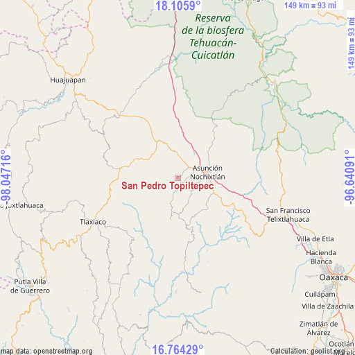
San Pedro Topiltepec GPS coordinates[2]
17° 26' 10.788" North, 97° 20' 38.508" West
| Map corner | latitude | longitude |
|---|---|---|
| Upper-left | 18.1059°, | -98.04716° |
| Center: | 17.43633°, | -97.34403° |
| Lower-right: | 16.76429°, | -96.64091° |
| Map W x H: | 149.2×149.2 km | = 92.7×92.7mi |
| max Lat: | 32.7° ⇑83.8% North |
| San Pedro Topiltepec: | 17.43633° |
| min Lat: | ⇓16.2% South 14.53588° |
| min Long | San Pedro Topil | max Long |
| -117.105° | -97.34403° | -86.73105° |
| W 71.1%⇐ | ⇒28.9% E |
Elevation
Elevation of San Pedro Topiltepec is 2162 m = 7093 ft, and this is 908.3 m = 2980 ft above average elevation for this country.
| Max E: |
3497 m = 11473 ft | 19.1% |
| San Pedro Topiltepec | 2162 m 7093 ft | |
| Avg. | 1253.7 m = 4113 ft | |
Min E: |
-1 m = -3 ft | 80.9% |
See also: Mexico elevation on elevation.city.
Geographical zone
San Pedro Topiltepec is located in North Torrid zone (between Equator and Tropic of Cancer). Distance of this Northern Tropic circle is 667.2 km =414.6 mi to North.| Distance of | km | miles | from San Pedro Topiltepec |
|---|---|---|---|
| North Pole | 8068.3 | 5013.4 | to North |
| Arctic Circle | 5462.4 | 3394.2 | to North |
| Tropic Cancer | 667.2 | 414.6 | to North |
| Equator | 1938.7 | 1204.7 | to South |


Nearby cities:
15 places around San Pedro Topiltepec: (largest is in red/bold)
• Magdalena Yodocono de Porfirio Díaz
5.9 km =3.7 mi,  191°
191°
• San Andrés Sinaxtla
7.4 km =4.6 mi,  60°
60°
• San Francisco Chindúa
3.5 km =2.2 mi,  105°
105°
• San Francisco Jaltepetongo
10.1 km =6.3 mi,  123°
123°
• San Francisco Nuxaño
6.1 km =3.8 mi,  178°
178°
• San Juan Sayultepec
6.6 km =4.1 mi,  73°
73°
• San Mateo Etlatongo
7.8 km =4.8 mi, 106°
• San Miguel Tecomatlán
9.3 km =5.8 mi, 120°
• San Pedro Tidaá
11 km =6.8 mi,  195°
195°
• San Vicente Nuñu
10.8 km =6.7 mi,  282°
282°
• Santiago Nejapilla
3.7 km =2.3 mi,  240°
240°
• Santiago Tillo
3.7 km =2.3 mi,  42°
42°
• Santo Domingo Tlatayapam
3.2 km =2 mi, 183°
• Santo Domingo Yanhuitlán
10.3 km =6.4 mi,  0°
0°
• Yucuita
11.4 km =7.1 mi, 43°
Sources, notices
• [Note1] Compared only with cities in Mexico existing in our database
• [Src1] Map data: © OpenStreetMap contributors (CC-BY-SA)
• [Src2] Other city data from geonames.org with taken over terms of usage.
• [Src3] Geographical zone / Annual Mean Temperature by Robert A. Rohde @ Wikipedia
