Tamazulapam Villa del Progreso geodata
Tamazulapam Villa del Progreso (Oaxaca) is a populated place; located in Mexico in America/Mexico_City (GMT-6) time zone. With population of 5,028 people, there are 1835 cities with bigger population in this country. Compared to other cities in Mexico, 81.5% of cities are located further ↑North; 68.7% of cities are located further ←West and 74.2% of cities have lower elevation than Tamazulapam Villa del Progreso. Note1
Current local time in Tamazulapam Villa del Progreso:
05:08 AM, WednesdayDifference from your time zone: hours


Tamazulapam Villa del Progreso GPS coordinates[2]
17° 40' 37.56" North, 97° 34' 23.34" West
| Map corner | latitude | longitude |
|---|---|---|
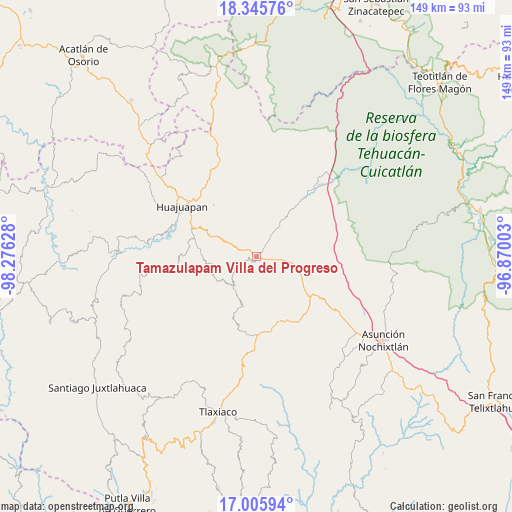
| Upper-left | 18.34576°, | -98.27628° |
| Center: | 17.6771°, | -97.57315° |
| Lower-right: | 17.00594°, | -96.87003° |
| Map W x H: | 149×149 km | = 92.6×92.6mi |
| max Lat: | 32.7° ⇑81.5% North |
| Tamazulapam Villa del Progreso: | 17.6771° |
| min Lat: | ⇓18.5% South 14.53588° |
| min Long | Tamazulapam Vil | max Long |
| -117.105° | -97.57315° | -86.73105° |
| W 68.7%⇐ | ⇒31.3% E |
Elevation
Elevation of Tamazulapam Villa del Progreso is 2017 m = 6617 ft, and this is 763.3 m = 2504 ft above average elevation for this country.
| Max E: |
3497 m = 11473 ft | 25.8% |
| Tamazulapam Villa del Progreso | 2017 m 6617 ft | |
| Avg. | 1253.7 m = 4113 ft | |
Min E: |
-1 m = -3 ft | 74.2% |
See also: Mexico elevation on elevation.city.
Geographical zone
Tamazulapam Villa del Progreso is located in North Torrid zone (between Equator and Tropic of Cancer). Distance of this Northern Tropic circle is 640.4 km =397.9 mi to North.| Distance of | km | miles | from Tamazulapam Villa del Progreso |
|---|---|---|---|
| North Pole | 8041.6 | 4996.8 | to North |
| Arctic Circle | 5435.7 | 3377.6 | to North |
| Tropic Cancer | 640.4 | 397.9 | to North |
| Equator | 1965.5 | 1221.3 | to South |


Nearby cities:
15 places around Tamazulapam Villa del Progreso: (largest is in red/bold)
• Corral de Piedra
19.2 km =11.9 mi,  295°
295°
• El Molino
21.9 km =13.6 mi, 299°
• San Andrés Dinicuiti
16.3 km =10.1 mi,  274°
274°
• San Antonio de León
17.2 km =10.7 mi,  277°
277°
• San Pedro y San Pablo Teposcolula
20.5 km =12.7 mi,  153°
153°
• San Sebastián Nicananduta
21.2 km =13.2 mi,  213°
213°
• San Sebastián Progreso
19.5 km =12.1 mi,  320°
320°
• Santa María Chilapa de Díaz
21.3 km =13.2 mi, 213°
• Santiago Cacaloxtepec
18.4 km =11.4 mi,  285°
285°
• Santiago Huajolotitlán
23.8 km =14.8 mi,  314°
314°
• Santiago Yolomécatl
22.8 km =14.2 mi,  179°
179°
• Santo Domingo Yodohino
13.4 km =8.3 mi,  240°
240°
• Teotongo
6.7 km =4.2 mi,  37°
37°
• Villa Tejúpam de la Unión
11 km =6.8 mi,  98°
98°
• Vista Hermosa
23.6 km =14.7 mi, 304°
Sources, notices
• [Note1] Compared only with cities in Mexico existing in our database
• [Src1] Map data: © OpenStreetMap contributors (CC-BY-SA)
• [Src2] Other city data from geonames.org with taken over terms of usage.
• [Src3] Geographical zone / Annual Mean Temperature by Robert A. Rohde @ Wikipedia
