San Juan Ihualtepec geodata
San Juan Ihualtepec (Oaxaca) is a seat of a second-order administrative division; located in Mexico in America/Mexico_City (GMT-6) time zone. With population of 408 people, there are 16842 cities with bigger population in this country. Compared to other cities in Mexico, 81% of cities are located further ↑North; 60% of cities are located further ←West and 63.5% of cities have lower elevation than San Juan Ihualtepec. Note1


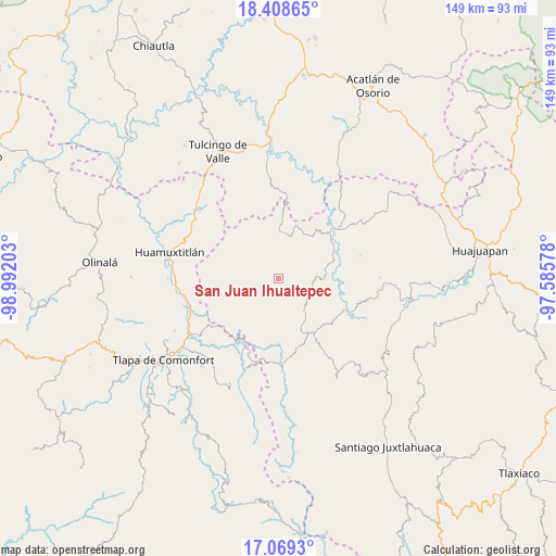
San Juan Ihualtepec GPS coordinates[2]
17° 44' 24.828" North, 98° 17' 20.04" West
| Map corner | latitude | longitude |
|---|---|---|
| Upper-left | 18.40865°, | -98.99203° |
| Center: | 17.74023°, | -98.2889° |
| Lower-right: | 17.0693°, | -97.58578° |
| Map W x H: | 148.9×148.9 km | = 92.5×92.5mi |
| max Lat: | 32.7° ⇑81% North |
| San Juan Ihualtepec: | 17.74023° |
| min Lat: | ⇓19% South 14.53588° |
| min Long | San Juan Ihualt | max Long |
| -117.105° | -98.2889° | -86.73105° |
| W 60%⇐ | ⇒40% E |
Elevation
Elevation of San Juan Ihualtepec is 1789 m = 5869 ft, and this is 535.3 m = 1756 ft above average elevation for this country.
| Max E: |
3497 m = 11473 ft | 36.5% |
| San Juan Ihualtepec | 1789 m 5869 ft | |
| Avg. | 1253.7 m = 4113 ft | |
Min E: |
-1 m = -3 ft | 63.5% |
See also: Mexico elevation on elevation.city.
Geographical zone
San Juan Ihualtepec is located in North Torrid zone (between Equator and Tropic of Cancer). Distance of this Northern Tropic circle is 633.4 km =393.6 mi to North.| Distance of | km | miles | from San Juan Ihualtepec |
|---|---|---|---|
| North Pole | 8034.5 | 4992.4 | to North |
| Arctic Circle | 5428.6 | 3373.2 | to North |
| Tropic Cancer | 633.4 | 393.6 | to North |
| Equator | 1972.5 | 1225.7 | to South |


Nearby cities:
15 places around San Juan Ihualtepec: (largest is in red/bold)
• Ahuehuetitlán
8.4 km =5.2 mi,  203°
203°
• Guadalupe Ramírez
13.3 km =8.3 mi,  81°
81°
• Guadalupe del Recreo
8.1 km =5 mi,  325°
325°
• Nicolás Hidalgo
16.1 km =10 mi,  72°
72°
• San Juan la Ciénega
12.3 km =7.6 mi,  4°
4°
• San Luis Morelia
8.9 km =5.5 mi,  117°
117°
• San Mateo Nejápam
16.5 km =10.3 mi,  235°
235°
• Santa Ana Rayón
13.5 km =8.4 mi, 0°
• Santa Cruz Tacache de Mina
17.4 km =10.8 mi,  55°
55°
• Santa Cruz de Bravo
19 km =11.8 mi,  158°
158°
• Tamazola
10.6 km =6.6 mi,  137°
137°
• Tepetlapa
13.7 km =8.5 mi,  232°
232°
• Tlachichilco
14.3 km =8.9 mi, 203°
• Yucuyachi
17.6 km =10.9 mi,  146°
146°
• Zapotitlán Lagunas
10.8 km =6.7 mi,  279°
279°
Sources, notices
• [Note1] Compared only with cities in Mexico existing in our database
• [Src1] Map data: © OpenStreetMap contributors (CC-BY-SA)
• [Src2] Other city data from geonames.org with taken over terms of usage.
• [Src3] Geographical zone / Annual Mean Temperature by Robert A. Rohde @ Wikipedia
