San Juan la Ciénega geodata
San Juan la Ciénega (Oaxaca) is a populated place; located in Mexico in America/Mexico_City (GMT-6) time zone. With population of 602 people, there are 14290 cities with bigger population in this country. Compared to other cities in Mexico, 80.1% of cities are located further ↑North; 60.1% of cities are located further ←West and 50.5% of cities have higher elevation than San Juan la Ciénega. Note1


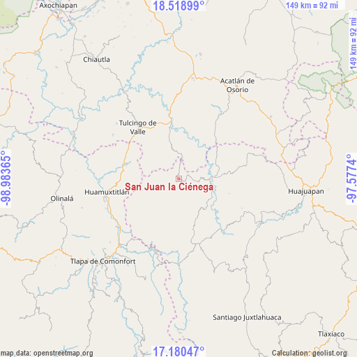
San Juan la Ciénega GPS coordinates[2]
17° 51' 3.564" North, 98° 16' 49.872" West
| Map corner | latitude | longitude |
|---|---|---|
| Upper-left | 18.51899°, | -98.98365° |
| Center: | 17.85099°, | -98.28052° |
| Lower-right: | 17.18047°, | -97.5774° |
| Map W x H: | 148.8×148.8 km | = 92.5×92.5mi |
| max Lat: | 32.7° ⇑80.1% North |
| San Juan la Ciénega: | 17.85099° |
| min Lat: | ⇓19.9% South 14.53588° |
| min Long | San Juan la Ci� | max Long |
| -117.105° | -98.28052° | -86.73105° |
| W 60.1%⇐ | ⇒39.9% E |
Elevation
Elevation of San Juan la Ciénega is 1407 m = 4616 ft, and this is 153.3 m = 503 ft above average elevation for this country.
| Max E: |
3497 m = 11473 ft | 50.5% |
| San Juan la Ciénega | 1407 m 4616 ft | |
| Avg. | 1253.7 m = 4113 ft | |
Min E: |
-1 m = -3 ft | 49.5% |
See also: Mexico elevation on elevation.city.
Geographical zone
San Juan la Ciénega is located in North Torrid zone (between Equator and Tropic of Cancer). Distance of this Northern Tropic circle is 621.1 km =385.9 mi to North.| Distance of | km | miles | from San Juan la Ciénega |
|---|---|---|---|
| North Pole | 8022.2 | 4984.8 | to North |
| Arctic Circle | 5416.3 | 3365.5 | to North |
| Tropic Cancer | 621.1 | 385.9 | to North |
| Equator | 1984.8 | 1233.3 | to South |


Nearby cities:
15 places around San Juan la Ciénega: (largest is in red/bold)
• Guadalupe Ramírez
16 km =9.9 mi,  130°
130°
• Guadalupe Victoria
18 km =11.2 mi,  321°
321°
• Guadalupe del Recreo
7.9 km =4.9 mi,  224°
224°
• Ilamacingo
17.8 km =11.1 mi,  13°
13°
• Mariscala de Juárez
14.8 km =9.2 mi,  86°
86°
• Nicolás Hidalgo
16.3 km =10.1 mi,  117°
117°
• Olomatlán
10.6 km =6.6 mi, 6°
• San Antonio Chiltepec
20.4 km =12.7 mi,  32°
32°
• San Juan Ihualtepec
12.3 km =7.6 mi,  184°
184°
• San Luis Morelia
17.8 km =11.1 mi,  156°
156°
• San Miguel Tlaltepexi
16.7 km =10.4 mi,  295°
295°
• Santa Ana Rayón
1.4 km =0.9 mi,  326°
326°
• Santa Cruz Tacache de Mina
13.7 km =8.5 mi,  100°
100°
• Xixingo de los Reyes
14.1 km =8.8 mi,  289°
289°
• Zapotitlán Lagunas
15.6 km =9.7 mi,  227°
227°
Sources, notices
• [Note1] Compared only with cities in Mexico existing in our database
• [Src1] Map data: © OpenStreetMap contributors (CC-BY-SA)
• [Src2] Other city data from geonames.org with taken over terms of usage.
• [Src3] Geographical zone / Annual Mean Temperature by Robert A. Rohde @ Wikipedia
