Arroyo Murciélago geodata
Arroyo Murciélago (Oaxaca) is a populated place; located in Mexico in America/Mexico_City (GMT-6) time zone. With population of 639 people, there are 13559 cities with bigger population in this country. Compared to other cities in Mexico, 76.9% of cities are located further ↑North; 79.4% of cities are located further ←West and 79.9% of cities have higher elevation than Arroyo Murciélago. Note1


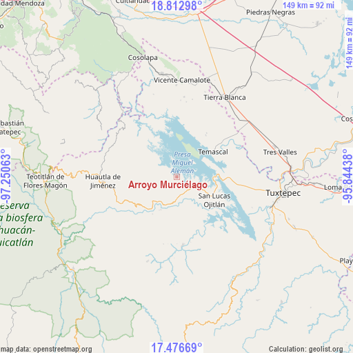
Arroyo Murciélago GPS coordinates[2]
18° 8' 45.996" North, 96° 32' 51" West
| Map corner | latitude | longitude |
|---|---|---|
| Upper-left | 18.81298°, | -97.25063° |
| Center: | 18.14611°, | -96.5475° |
| Lower-right: | 17.47669°, | -95.84438° |
| Map W x H: | 148.6×148.6 km | = 92.3×92.3mi |
| max Lat: | 32.7° ⇑76.9% North |
| Arroyo Murciélago: | 18.14611° |
| min Lat: | ⇓23.1% South 14.53588° |
| min Long | Arroyo Murciél | max Long |
| -117.105° | -96.5475° | -86.73105° |
| W 79.4%⇐ | ⇒20.6% E |
Elevation
Elevation of Arroyo Murciélago is 96 m = 315 ft, and this is 1157.7 m = 3798 ft below average elevation for this country.
| Max E: |
3497 m = 11473 ft | 79.9% |
| Avg. | 1253.7 m = 4113 ft | |
| Arroyo Murciélago | 96 m = 315 ft | |
Min E: |
-1 m = -3 ft | 20.1% |
See also: Mexico elevation on elevation.city.
Geographical zone
Arroyo Murciélago is located in North Torrid zone (between Equator and Tropic of Cancer). Distance of this Northern Tropic circle is 588.3 km =365.6 mi to North.| Distance of | km | miles | from Arroyo Murciélago |
|---|---|---|---|
| North Pole | 7989.4 | 4964.4 | to North |
| Arctic Circle | 5383.5 | 3345.2 | to North |
| Tropic Cancer | 588.3 | 365.6 | to North |
| Equator | 2017.7 | 1253.7 | to South |


Nearby cities:
15 places around Arroyo Murciélago: (largest is in red/bold)
• Agua de Tierra (Sección la Montaña)
7.8 km =4.8 mi,  146°
146°
• Arroyo Grande
7.4 km =4.6 mi,  135°
135°
• Arroyo Venado (Sección Tercera)
7.6 km =4.7 mi,  165°
165°
• Arroyo Zapotillo
7.8 km =4.8 mi,  177°
177°
• Camino de Ixcatlán
5.6 km =3.5 mi, 151°
• Cerro Quemado
3 km =1.9 mi,  287°
287°
• Colonia la Central
7.4 km =4.6 mi, 153°
• El Progreso
2.2 km =1.4 mi, 176°
• La Permuta
8.4 km =5.2 mi,  132°
132°
• Loma San Juan
5.1 km =3.2 mi, 176°
• Los Zarates
5.7 km =3.5 mi, 140°
• San Felipe Jalapa de Díaz
8.4 km =5.2 mi, 171°
• San Felipe Tílpam
6.3 km =3.9 mi,  319°
319°
• San Pedro Ixcatlán
4 km =2.5 mi,  90°
90°
• Sección los Roques
6.5 km =4 mi, 136°
Sources, notices
• [Note1] Compared only with cities in Mexico existing in our database
• [Src1] Map data: © OpenStreetMap contributors (CC-BY-SA)
• [Src2] Other city data from geonames.org with taken over terms of usage.
• [Src3] Geographical zone / Annual Mean Temperature by Robert A. Rohde @ Wikipedia
