El Progreso geodata
El Progreso (Oaxaca) is a populated place; located in Mexico in America/Mexico_City (GMT-6) time zone. With population of 660 people, there are 13154 cities with bigger population in this country. Compared to other cities in Mexico, 77.2% of cities are located further ↑North; 79.4% of cities are located further ←West and 71.9% of cities have higher elevation than El Progreso. Note1


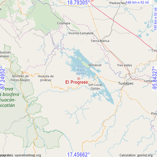
El Progreso GPS coordinates[2]
18° 7' 33.996" North, 96° 32' 47.004" West
| Map corner | latitude | longitude |
|---|---|---|
| Upper-left | 18.79305°, | -97.24952° |
| Center: | 18.12611°, | -96.54639° |
| Lower-right: | 17.45662°, | -95.84327° |
| Map W x H: | 148.6×148.6 km | = 92.3×92.3mi |
| max Lat: | 32.7° ⇑77.2% North |
| El Progreso: | 18.12611° |
| min Lat: | ⇓22.8% South 14.53588° |
| min Long | El Progreso | max Long |
| -117.105° | -96.54639° | -86.73105° |
| W 79.4%⇐ | ⇒20.6% E |
Elevation
Elevation of El Progreso is 331 m = 1086 ft, and this is 922.7 m = 3027 ft below average elevation for this country.
| Max E: |
3497 m = 11473 ft | 71.9% |
| Avg. | 1253.7 m = 4113 ft | |
| El Progreso | 331 m = 1086 ft | |
Min E: |
-1 m = -3 ft | 28.1% |
See also: Mexico elevation on elevation.city.
Geographical zone
El Progreso is located in North Torrid zone (between Equator and Tropic of Cancer). Distance of this Northern Tropic circle is 590.5 km =366.9 mi to North.| Distance of | km | miles | from El Progreso |
|---|---|---|---|
| North Pole | 7991.6 | 4965.7 | to North |
| Arctic Circle | 5385.7 | 3346.5 | to North |
| Tropic Cancer | 590.5 | 366.9 | to North |
| Equator | 2015.4 | 1252.3 | to South |


Nearby cities:
15 places around El Progreso: (largest is in red/bold)
• Agua de Tierra (Sección la Montaña)
6 km =3.7 mi,  135°
135°
• Arroyo Espuma
7.3 km =4.5 mi,  182°
182°
• Arroyo Grande
5.9 km =3.7 mi,  120°
120°
• Arroyo Murciélago
2.2 km =1.4 mi,  356°
356°
• Arroyo Venado (Sección Tercera)
5.5 km =3.4 mi,  160°
160°
• Arroyo Zapotillo
5.5 km =3.4 mi, 177°
• Camino de Ixcatlán
3.8 km =2.4 mi, 136°
• Cerro Quemado
4.3 km =2.7 mi,  315°
315°
• Colonia la Central
5.4 km =3.4 mi, 143°
• La Permuta
7 km =4.3 mi, 119°
• Loma San Juan
2.9 km =1.8 mi, 175°
• Los Zarates
4.1 km =2.5 mi, 121°
• San Felipe Jalapa de Díaz
6.2 km =3.9 mi,  169°
169°
• San Pedro Ixcatlán
4.5 km =2.8 mi,  60°
60°
• Sección los Roques
5 km =3.1 mi, 119°
Sources, notices
• [Note1] Compared only with cities in Mexico existing in our database
• [Src1] Map data: © OpenStreetMap contributors (CC-BY-SA)
• [Src2] Other city data from geonames.org with taken over terms of usage.
• [Src3] Geographical zone / Annual Mean Temperature by Robert A. Rohde @ Wikipedia
