Joliette geodata
Joliette (Veracruz) is a populated place; located in Mexico in America/Mexico_City (GMT-6) time zone. With population of 749 people, there are 11695 cities with bigger population in this country. Compared to other cities in Mexico, 73.6% of cities are located further ↑North; 80.4% of cities are located further ←West and 83.3% of cities have higher elevation than Joliette. Note1


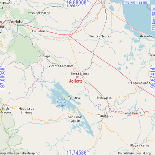
Joliette GPS coordinates[2]
18° 24' 51.336" North, 96° 22' 38.136" West
| Map corner | latitude | longitude |
|---|---|---|
| Upper-left | 19.08008°, | -97.08039° |
| Center: | 18.41426°, | -96.37726° |
| Lower-right: | 17.74586°, | -95.67414° |
| Map W x H: | 148.4×148.4 km | = 92.2×92.2mi |
| max Lat: | 32.7° ⇑73.6% North |
| Joliette: | 18.41426° |
| min Lat: | ⇓26.4% South 14.53588° |
| min Long | Joliette | max Long |
| -117.105° | -96.37726° | -86.73105° |
| W 80.4%⇐ | ⇒19.6% E |
Elevation
Elevation of Joliette is 58 m = 190 ft, and this is 1195.7 m = 3923 ft below average elevation for this country.
| Max E: |
3497 m = 11473 ft | 83.3% |
| Avg. | 1253.7 m = 4113 ft | |
| Joliette | 58 m = 190 ft | |
Min E: |
-1 m = -3 ft | 16.7% |
See also: Mexico elevation on elevation.city.
Geographical zone
Joliette is located in North Torrid zone (between Equator and Tropic of Cancer). Distance of this Northern Tropic circle is 558.4 km =347 mi to North.| Distance of | km | miles | from Joliette |
|---|---|---|---|
| North Pole | 7959.6 | 4945.9 | to North |
| Arctic Circle | 5353.7 | 3326.6 | to North |
| Tropic Cancer | 558.4 | 347 | to North |
| Equator | 2047.5 | 1272.3 | to South |


Nearby cities:
15 places around Joliette: (largest is in red/bold)
• Arroyo de Pita
2.8 km =1.7 mi,  146°
146°
• Carbonera
6.3 km =3.9 mi,  303°
303°
• El Cedral
12 km =7.5 mi,  243°
243°
• La Atalaya
7.8 km =4.8 mi,  101°
101°
• La Palma
8.4 km =5.2 mi,  315°
315°
• La Patria
12.5 km =7.8 mi,  205°
205°
• La Raya
1.6 km =1 mi,  134°
134°
• La Reforma
13.4 km =8.3 mi,  160°
160°
• La Tabaquera
11.7 km =7.3 mi,  221°
221°
• La Victoria
7.5 km =4.7 mi,  49°
49°
• Nuevo Pescadito de Málzaga (La Breña)
6.8 km =4.2 mi,  183°
183°
• Palma Sola
4.2 km =2.6 mi,  85°
85°
• Rancho Grande
7.3 km =4.5 mi, 156°
• Tembladera del Castillo
13.1 km =8.1 mi,  259°
259°
• Tierra Blanca
4.2 km =2.6 mi,  27°
27°
Sources, notices
• [Note1] Compared only with cities in Mexico existing in our database
• [Src1] Map data: © OpenStreetMap contributors (CC-BY-SA)
• [Src2] Other city data from geonames.org with taken over terms of usage.
• [Src3] Geographical zone / Annual Mean Temperature by Robert A. Rohde @ Wikipedia
