Santa Cruz Nexila geodata
Santa Cruz Nexila (Oaxaca) is a populated place; located in Mexico in America/Mexico_City (GMT-6) time zone. With population of 744 people, there are 11771 cities with bigger population in this country. Compared to other cities in Mexico, 93.4% of cities are located further ↑North; 76.7% of cities are located further ←West and 50.1% of cities have lower elevation than Santa Cruz Nexila. Note1


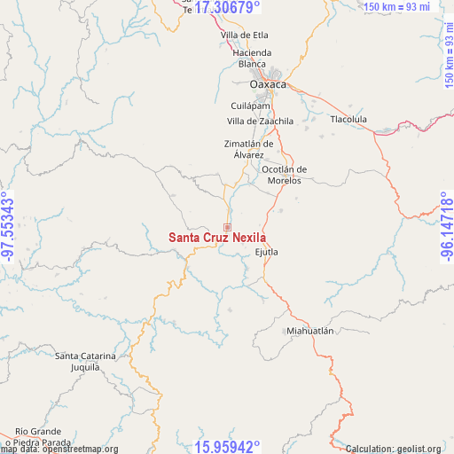
Santa Cruz Nexila GPS coordinates[2]
16° 38' 3.444" North, 96° 51' 1.08" West
| Map corner | latitude | longitude |
|---|---|---|
| Upper-left | 17.30679°, | -97.55343° |
| Center: | 16.63429°, | -96.8503° |
| Lower-right: | 15.95942°, | -96.14718° |
| Map W x H: | 149.8×149.8 km | = 93.1×93.1mi |
| max Lat: | 32.7° ⇑93.4% North |
| Santa Cruz Nexila: | 16.63429° |
| min Lat: | ⇓6.6% South 14.53588° |
| min Long | Santa Cruz Nexi | max Long |
| -117.105° | -96.8503° | -86.73105° |
| W 76.7%⇐ | ⇒23.3% E |
Elevation
Elevation of Santa Cruz Nexila is 1437 m = 4715 ft, and this is 183.3 m = 601 ft above average elevation for this country.
| Max E: |
3497 m = 11473 ft | 49.9% |
| Santa Cruz Nexila | 1437 m 4715 ft | |
| Avg. | 1253.7 m = 4113 ft | |
Min E: |
-1 m = -3 ft | 50.1% |
See also: Mexico elevation on elevation.city.
Geographical zone
Santa Cruz Nexila is located in North Torrid zone (between Equator and Tropic of Cancer). Distance of this Northern Tropic circle is 756.4 km =470 mi to North.| Distance of | km | miles | from Santa Cruz Nexila |
|---|---|---|---|
| North Pole | 8157.5 | 5068.8 | to North |
| Arctic Circle | 5551.6 | 3449.6 | to North |
| Tropic Cancer | 756.4 | 470 | to North |
| Equator | 1849.6 | 1149.3 | to South |


Nearby cities:
15 places around Santa Cruz Nexila: (largest is in red/bold)
• Agua Fría Campanario
13.7 km =8.5 mi,  330°
330°
• Agua del Espino
7 km =4.3 mi,  133°
133°
• Ayoquezco de Aldama
5.6 km =3.5 mi,  8°
8°
• El Vergel
10.6 km =6.6 mi,  86°
86°
• La Compañía
9.1 km =5.7 mi,  158°
158°
• La Pe
5.6 km =3.5 mi, 94°
• Monte del Toro
12.8 km =8 mi,  67°
67°
• San Andrés Zabache
3.9 km =2.4 mi,  191°
191°
• San Martín Lachila
2.5 km =1.6 mi,  176°
176°
• San Martín de los Canseco
13.3 km =8.3 mi,  79°
79°
• San Miguel Ejutla
13.3 km =8.3 mi,  116°
116°
• San Sebastián de las Grutas
11.4 km =7.1 mi,  268°
268°
• Santa Ana Tlapacoyan
12.2 km =7.6 mi, 6°
• Santa Martha Chichihualtepec
8.2 km =5.1 mi, 78°
• Taniche
12.5 km =7.8 mi, 125°
Sources, notices
• [Note1] Compared only with cities in Mexico existing in our database
• [Src1] Map data: © OpenStreetMap contributors (CC-BY-SA)
• [Src2] Other city data from geonames.org with taken over terms of usage.
• [Src3] Geographical zone / Annual Mean Temperature by Robert A. Rohde @ Wikipedia
