San Martín Lachila geodata
San Martín Lachila (Oaxaca) is a populated place; located in Mexico in America/Mexico_City (GMT-6) time zone. With population of 1,066 people, there are 8182 cities with bigger population in this country. Compared to other cities in Mexico, 93.5% of cities are located further ↑North; 76.7% of cities are located further ←West and 50% of cities have lower elevation than San Martín Lachila. Note1


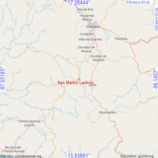
San Martín Lachila GPS coordinates[2]
16° 36' 42.696" North, 96° 50' 55.752" West
| Map corner | latitude | longitude |
|---|---|---|
| Upper-left | 17.28444°, | -97.55195° |
| Center: | 16.61186°, | -96.84882° |
| Lower-right: | 15.93691°, | -96.1457° |
| Map W x H: | 149.8×149.8 km | = 93.1×93.1mi |
| max Lat: | 32.7° ⇑93.5% North |
| San Martín Lachila: | 16.61186° |
| min Lat: | ⇓6.5% South 14.53588° |
| min Long | San Martín Lac | max Long |
| -117.105° | -96.84882° | -86.73105° |
| W 76.7%⇐ | ⇒23.3% E |
Elevation
Elevation of San Martín Lachila is 1431 m = 4695 ft, and this is 177.3 m = 582 ft above average elevation for this country.
| Max E: |
3497 m = 11473 ft | 50% |
| San Martín Lachila | 1431 m 4695 ft | |
| Avg. | 1253.7 m = 4113 ft | |
Min E: |
-1 m = -3 ft | 50% |
See also: Mexico elevation on elevation.city.
Geographical zone
San Martín Lachila is located in North Torrid zone (between Equator and Tropic of Cancer). Distance of this Northern Tropic circle is 758.9 km =471.6 mi to North.| Distance of | km | miles | from San Martín Lachila |
|---|---|---|---|
| North Pole | 8160 | 5070.4 | to North |
| Arctic Circle | 5554.1 | 3451.2 | to North |
| Tropic Cancer | 758.9 | 471.6 | to North |
| Equator | 1847.1 | 1147.7 | to South |


Nearby cities:
15 places around San Martín Lachila: (largest is in red/bold)
• Agua del Espino
5.5 km =3.4 mi,  115°
115°
• Ayoquezco de Aldama
8 km =5 mi,  4°
4°
• Ejutla de Crespo
13.5 km =8.4 mi,  112°
112°
• El Vergel
10.9 km =6.8 mi,  72°
72°
• Hacienda Vieja
12.5 km =7.8 mi,  129°
129°
• La Compañía
6.7 km =4.2 mi,  152°
152°
• La Pe
5.8 km =3.6 mi, 69°
• Los Ocotes
13.7 km =8.5 mi,  88°
88°
• San Agustín Amatengo
12.9 km =8 mi, 150°
• San Andrés Zabache
1.7 km =1.1 mi,  214°
214°
• San Miguel Ejutla
12.2 km =7.6 mi, 106°
• San Sebastián de las Grutas
11.8 km =7.3 mi,  280°
280°
• Santa Cruz Nexila
2.5 km =1.6 mi,  356°
356°
• Santa Martha Chichihualtepec
9 km =5.6 mi,  62°
62°
• Taniche
11.1 km =6.9 mi, 115°
Sources, notices
• [Note1] Compared only with cities in Mexico existing in our database
• [Src1] Map data: © OpenStreetMap contributors (CC-BY-SA)
• [Src2] Other city data from geonames.org with taken over terms of usage.
• [Src3] Geographical zone / Annual Mean Temperature by Robert A. Rohde @ Wikipedia
