Mazateupa geodata
Mazateupa (Tabasco) is a populated place; located in Mexico in America/Mexico_City (GMT-6) time zone. With population of 2,304 people, there are 3826 cities with bigger population in this country. Compared to other cities in Mexico, 76.2% of cities are located further ↑North; 88.5% of cities are located further ←West and 99.1% of cities have higher elevation than Mazateupa. Note1


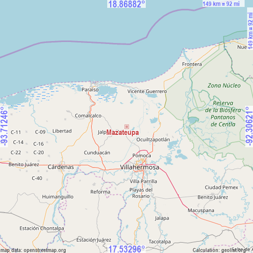
Mazateupa GPS coordinates[2]
18° 12' 7.812" North, 93° 0' 33.588" West
| Map corner | latitude | longitude |
|---|---|---|
| Upper-left | 18.86882°, | -93.71246° |
| Center: | 18.20217°, | -93.00933° |
| Lower-right: | 17.53296°, | -92.30621° |
| Map W x H: | 148.5×148.5 km | = 92.3×92.3mi |
| max Lat: | 32.7° ⇑76.2% North |
| Mazateupa: | 18.20217° |
| min Lat: | ⇓23.8% South 14.53588° |
| min Long | Mazateupa | max Long |
| -117.105° | -93.00933° | -86.73105° |
| W 88.5%⇐ | ⇒11.5% E |
Elevation
Elevation of Mazateupa is 6 m = 20 ft, and this is 1247.7 m = 4094 ft below average elevation for this country.
| Max E: |
3497 m = 11473 ft | 99.1% |
| Avg. | 1253.7 m = 4113 ft | |
| Mazateupa | 6 m = 20 ft | |
Min E: |
-1 m = -3 ft | 0.9% |
See also: Mexico elevation on elevation.city.
Geographical zone
Mazateupa is located in North Torrid zone (between Equator and Tropic of Cancer). Distance of this Northern Tropic circle is 582 km =361.6 mi to North.| Distance of | km | miles | from Mazateupa |
|---|---|---|---|
| North Pole | 7983.2 | 4960.5 | to North |
| Arctic Circle | 5377.3 | 3341.3 | to North |
| Tropic Cancer | 582 | 361.6 | to North |
| Equator | 2023.9 | 1257.6 | to South |


Nearby cities:
15 places around Mazateupa: (largest is in red/bold)
• Corriente 1ra. Sección
5.2 km =3.2 mi,  161°
161°
• Guatacalca
5.2 km =3.2 mi,  141°
141°
• Guaytalpa
3 km =1.9 mi,  304°
304°
• Isla Guadalupe
7.1 km =4.4 mi,  77°
77°
• Jalpa de Méndez
6.4 km =4 mi,  243°
243°
• Nacajuca
3.7 km =2.3 mi,  194°
194°
• Olcuatitán
5.3 km =3.3 mi,  104°
104°
• Oxiacaque
6.7 km =4.2 mi, 78°
• San Simón
4.7 km =2.9 mi,  325°
325°
• Soyataco
6.9 km =4.3 mi,  277°
277°
• Tapotzingo
0.6 km =0.4 mi, 295°
• Taxco
7 km =4.3 mi,  176°
176°
• Tecoluta 2da. Sección
4.8 km =3 mi,  346°
346°
• Tierras Peleadas (Tierras Amigas)
6.9 km =4.3 mi,  204°
204°
• Tucta
1.8 km =1.1 mi,  123°
123°
Sources, notices
• [Note1] Compared only with cities in Mexico existing in our database
• [Src1] Map data: © OpenStreetMap contributors (CC-BY-SA)
• [Src2] Other city data from geonames.org with taken over terms of usage.
• [Src3] Geographical zone / Annual Mean Temperature by Robert A. Rohde @ Wikipedia
