Zacate Grande geodata
Zacate Grande (Hidalgo) is a populated place; located in Mexico in America/Mexico_City (GMT-6) time zone. With population of 571 people, there are 14980 cities with bigger population in this country. Compared to other cities in Mexico, 78.1% of cities are located further ↓South; 50.1% of cities are located further ←West and 51.4% of cities have lower elevation than Zacate Grande. Note1


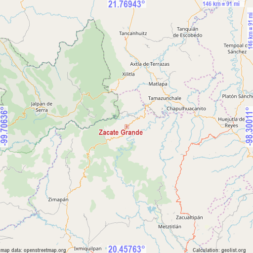
Zacate Grande GPS coordinates[2]
21° 6' 53.928" North, 99° 0' 11.628" West
| Map corner | latitude | longitude |
|---|---|---|
| Upper-left | 21.76943°, | -99.70636° |
| Center: | 21.11498°, | -99.00323° |
| Lower-right: | 20.45763°, | -98.30011° |
| Map W x H: | 145.9×145.9 km | = 90.7×90.7mi |
| max Lat: | 32.7° ⇑21.9% North |
| Zacate Grande: | 21.11498° |
| min Lat: | ⇓78.1% South 14.53588° |
| min Long | Zacate Grande | max Long |
| -117.105° | -99.00323° | -86.73105° |
| W 50.1%⇐ | ⇒49.9% E |
Elevation
Elevation of Zacate Grande is 1501 m = 4925 ft, and this is 247.3 m = 811 ft above average elevation for this country.
| Max E: |
3497 m = 11473 ft | 48.6% |
| Zacate Grande | 1501 m 4925 ft | |
| Avg. | 1253.7 m = 4113 ft | |
Min E: |
-1 m = -3 ft | 51.4% |
See also: Mexico elevation on elevation.city.
Geographical zone
Zacate Grande is located in North Torrid zone (between Equator and Tropic of Cancer). Distance of this Northern Tropic circle is 258.2 km =160.4 mi to North.| Distance of | km | miles | from Zacate Grande |
|---|---|---|---|
| North Pole | 7659.3 | 4759.3 | to North |
| Arctic Circle | 5053.4 | 3140 | to North |
| Tropic Cancer | 258.2 | 160.4 | to North |
| Equator | 2347.8 | 1458.9 | to South |


Nearby cities:
15 places around Zacate Grande: (largest is in red/bold)
• Ahuatetla
12.2 km =7.6 mi,  130°
130°
• Amola de Ocampo
12.1 km =7.5 mi,  113°
113°
• Chapulhuacán
11.4 km =7.1 mi,  65°
65°
• El Coyol
5.8 km =3.6 mi,  176°
176°
• Iglesia Vieja
3.8 km =2.4 mi,  103°
103°
• La Loma
11.3 km =7 mi,  48°
48°
• Neblinas
8.3 km =5.2 mi,  89°
89°
• Palo Semita
1.1 km =0.7 mi,  172°
172°
• Pisaflores
8.8 km =5.5 mi,  358°
358°
• San Pedro Xochicuaco
12.1 km =7.5 mi,  5°
5°
• San Rafael
6.8 km =4.2 mi, 89°
• Santa Ana de Allende
2 km =1.2 mi,  63°
63°
• Santa María de Álamos
4.1 km =2.5 mi, 56°
• Tenango
9.9 km =6.2 mi, 130°
• Xuchiatipa
11.8 km =7.3 mi,  153°
153°
Sources, notices
• [Note1] Compared only with cities in Mexico existing in our database
• [Src1] Map data: © OpenStreetMap contributors (CC-BY-SA)
• [Src2] Other city data from geonames.org with taken over terms of usage.
• [Src3] Geographical zone / Annual Mean Temperature by Robert A. Rohde @ Wikipedia
