El Coyol geodata
El Coyol (Hidalgo) is a populated place; located in Mexico in America/Mexico_City (GMT-6) time zone. With population of 750 people, there are 11679 cities with bigger population in this country. Compared to other cities in Mexico, 77.4% of cities are located further ↓South; 50.2% of cities are located further ←West and 66.1% of cities have higher elevation than El Coyol. Note1


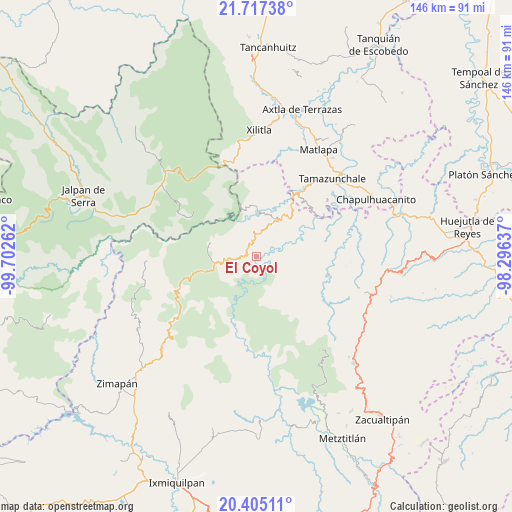
El Coyol GPS coordinates[2]
21° 3' 45.684" North, 98° 59' 58.164" West
| Map corner | latitude | longitude |
|---|---|---|
| Upper-left | 21.71738°, | -99.70262° |
| Center: | 21.06269°, | -98.99949° |
| Lower-right: | 20.40511°, | -98.29637° |
| Map W x H: | 145.9×145.9 km | = 90.7×90.7mi |
| max Lat: | 32.7° ⇑22.6% North |
| El Coyol: | 21.06269° |
| min Lat: | ⇓77.4% South 14.53588° |
| min Long | El Coyol | max Long |
| -117.105° | -98.99949° | -86.73105° |
| W 50.2%⇐ | ⇒49.8% E |
Elevation
Elevation of El Coyol is 632 m = 2073 ft, and this is 621.7 m = 2040 ft below average elevation for this country.
| Max E: |
3497 m = 11473 ft | 66.1% |
| Avg. | 1253.7 m = 4113 ft | |
| El Coyol | 632 m = 2073 ft | |
Min E: |
-1 m = -3 ft | 33.9% |
See also: Mexico elevation on elevation.city.
Geographical zone
El Coyol is located in North Torrid zone (between Equator and Tropic of Cancer). Distance of this Northern Tropic circle is 264 km =164 mi to North.| Distance of | km | miles | from El Coyol |
|---|---|---|---|
| North Pole | 7665.1 | 4762.9 | to North |
| Arctic Circle | 5059.2 | 3143.6 | to North |
| Tropic Cancer | 264 | 164 | to North |
| Equator | 2342 | 1455.3 | to South |


Nearby cities:
15 places around El Coyol: (largest is in red/bold)
• Ahuatetla
9.1 km =5.7 mi,  104°
104°
• Amola de Ocampo
10.8 km =6.7 mi,  84°
84°
• Buenavista
8.4 km =5.2 mi,  161°
161°
• Cuazahuatl
12.8 km =8 mi,  113°
113°
• Cuesta Colorada
12.8 km =8 mi,  251°
251°
• Iglesia Vieja
5.9 km =3.7 mi,  34°
34°
• Neblinas
9.8 km =6.1 mi,  53°
53°
• Palo Semita
4.7 km =2.9 mi,  356°
356°
• San Juan Ahuehueco
9.9 km =6.2 mi, 103°
• San Rafael
8.7 km =5.4 mi, 47°
• Santa Ana de Allende
6.9 km =4.3 mi,  11°
11°
• Santa María de Álamos
8.7 km =5.4 mi,  20°
20°
• Tenango
7.2 km =4.5 mi, 95°
• Xuchiatipa
6.9 km =4.3 mi,  133°
133°
• Zacate Grande
5.8 km =3.6 mi, 356°
Sources, notices
• [Note1] Compared only with cities in Mexico existing in our database
• [Src1] Map data: © OpenStreetMap contributors (CC-BY-SA)
• [Src2] Other city data from geonames.org with taken over terms of usage.
• [Src3] Geographical zone / Annual Mean Temperature by Robert A. Rohde @ Wikipedia
