San Juan Ahuehueco geodata
San Juan Ahuehueco (Hidalgo) is a populated place; located in Mexico in America/Mexico_City (GMT-6) time zone. With population of 1,535 people, there are 5625 cities with bigger population in this country. Compared to other cities in Mexico, 77.1% of cities are located further ↓South; 51.8% of cities are located further ←West and 59.2% of cities have higher elevation than San Juan Ahuehueco. Note1


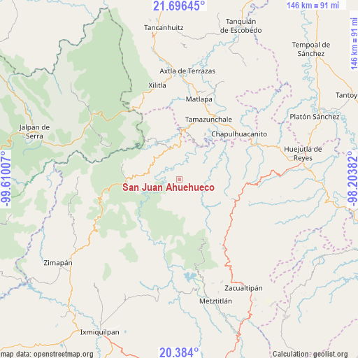
San Juan Ahuehueco GPS coordinates[2]
21° 2' 30.012" North, 98° 54' 24.984" West
| Map corner | latitude | longitude |
|---|---|---|
| Upper-left | 21.69645°, | -99.61007° |
| Center: | 21.04167°, | -98.90694° |
| Lower-right: | 20.384°, | -98.20382° |
| Map W x H: | 145.9×145.9 km | = 90.7×90.7mi |
| max Lat: | 32.7° ⇑22.9% North |
| San Juan Ahuehueco: | 21.04167° |
| min Lat: | ⇓77.1% South 14.53588° |
| min Long | San Juan Ahuehu | max Long |
| -117.105° | -98.90694° | -86.73105° |
| W 51.8%⇐ | ⇒48.2% E |
Elevation
Elevation of San Juan Ahuehueco is 1039 m = 3409 ft, and this is 214.7 m = 704 ft below average elevation for this country.
| Max E: |
3497 m = 11473 ft | 59.2% |
| Avg. | 1253.7 m = 4113 ft | |
| San Juan Ahuehueco | 1039 m = 3409 ft | |
Min E: |
-1 m = -3 ft | 40.8% |
See also: Mexico elevation on elevation.city.
Geographical zone
San Juan Ahuehueco is located in North Torrid zone (between Equator and Tropic of Cancer). Distance of this Northern Tropic circle is 266.3 km =165.5 mi to North.| Distance of | km | miles | from San Juan Ahuehueco |
|---|---|---|---|
| North Pole | 7667.4 | 4764.3 | to North |
| Arctic Circle | 5061.6 | 3145.1 | to North |
| Tropic Cancer | 266.3 | 165.5 | to North |
| Equator | 2339.6 | 1453.8 | to South |


Nearby cities:
15 places around San Juan Ahuehueco: (largest is in red/bold)
• Ahuatetla
0.8 km =0.5 mi,  279°
279°
• Amola de Ocampo
3.6 km =2.2 mi,  18°
18°
• Buenavista
8.9 km =5.5 mi,  231°
231°
• Chilijapa
5.2 km =3.2 mi,  131°
131°
• Cuazahuatl
3.5 km =2.2 mi,  143°
143°
• Iglesia Vieja
9.6 km =6 mi,  319°
319°
• La Reforma
5.2 km =3.2 mi,  47°
47°
• Neblinas
8.4 km =5.2 mi,  348°
348°
• San Miguel Ayotempa
9.3 km =5.8 mi, 141°
• San Rafael
8.8 km =5.5 mi,  338°
338°
• Tenango
3 km =1.9 mi,  304°
304°
• Tepehuacán de Guerrero
7.4 km =4.6 mi,  114°
114°
• Texcapa
7.9 km =4.9 mi,  44°
44°
• Teyahuala
6.5 km =4 mi,  81°
81°
• Xuchiatipa
5.2 km =3.2 mi,  242°
242°
Sources, notices
• [Note1] Compared only with cities in Mexico existing in our database
• [Src1] Map data: © OpenStreetMap contributors (CC-BY-SA)
• [Src2] Other city data from geonames.org with taken over terms of usage.
• [Src3] Geographical zone / Annual Mean Temperature by Robert A. Rohde @ Wikipedia
