Cuapaxtitla geodata
Cuapaxtitla (Hidalgo) is a populated place; located in Mexico in America/Mexico_City (GMT-6) time zone. With population of 1,129 people, there are 7682 cities with bigger population in this country. Compared to other cities in Mexico, 78.3% of cities are located further ↓South; 56.6% of cities are located further ←West and 74.3% of cities have higher elevation than Cuapaxtitla. Note1


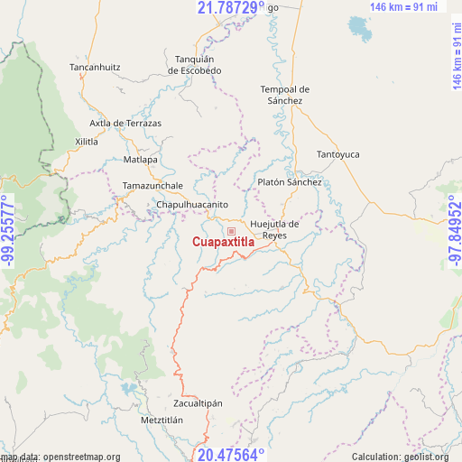
Cuapaxtitla GPS coordinates[2]
21° 7' 58.512" North, 98° 33' 9.504" West
| Map corner | latitude | longitude |
|---|---|---|
| Upper-left | 21.78729°, | -99.25577° |
| Center: | 21.13292°, | -98.55264° |
| Lower-right: | 20.47564°, | -97.84952° |
| Map W x H: | 145.8×145.8 km | = 90.6×90.6mi |
| max Lat: | 32.7° ⇑21.7% North |
| Cuapaxtitla: | 21.13292° |
| min Lat: | ⇓78.3% South 14.53588° |
| min Long | Cuapaxtitla | max Long |
| -117.105° | -98.55264° | -86.73105° |
| W 56.6%⇐ | ⇒43.4% E |
Elevation
Elevation of Cuapaxtitla is 243 m = 797 ft, and this is 1010.7 m = 3316 ft below average elevation for this country.
| Max E: |
3497 m = 11473 ft | 74.3% |
| Avg. | 1253.7 m = 4113 ft | |
| Cuapaxtitla | 243 m = 797 ft | |
Min E: |
-1 m = -3 ft | 25.7% |
See also: Mexico elevation on elevation.city.
Geographical zone
Cuapaxtitla is located in North Torrid zone (between Equator and Tropic of Cancer). Distance of this Northern Tropic circle is 256.2 km =159.2 mi to North.| Distance of | km | miles | from Cuapaxtitla |
|---|---|---|---|
| North Pole | 7657.3 | 4758 | to North |
| Arctic Circle | 5051.4 | 3138.8 | to North |
| Tropic Cancer | 256.2 | 159.2 | to North |
| Equator | 2349.8 | 1460.1 | to South |


Nearby cities:
15 places around Cuapaxtitla: (largest is in red/bold)
• Acoapa
6.9 km =4.3 mi,  100°
100°
• Axcaco
7.1 km =4.4 mi,  169°
169°
• Coacuilco
4.8 km =3 mi,  227°
227°
• Coamila
6.3 km =3.9 mi,  114°
114°
• Cochiscuatitla
8.1 km =5 mi,  1°
1°
• Contepec
6.4 km =4 mi,  87°
87°
• Ixcatlán
6 km =3.7 mi,  162°
162°
• Ixcatépec
5 km =3.1 mi,  135°
135°
• Jaltocan
1.4 km =0.9 mi, 90°
• La Capilla
3.6 km =2.2 mi,  54°
54°
• Macustepetla
7.5 km =4.7 mi, 98°
• San Felipe Orizatlán
7.1 km =4.4 mi,  306°
306°
• Talol
7.8 km =4.8 mi,  259°
259°
• Totonicapa
5.3 km =3.3 mi,  301°
301°
• Xocotitla
6.6 km =4.1 mi, 95°
Sources, notices
• [Note1] Compared only with cities in Mexico existing in our database
• [Src1] Map data: © OpenStreetMap contributors (CC-BY-SA)
• [Src2] Other city data from geonames.org with taken over terms of usage.
• [Src3] Geographical zone / Annual Mean Temperature by Robert A. Rohde @ Wikipedia
