Totonicapa geodata
Totonicapa (Hidalgo) is a populated place; located in Mexico in America/Mexico_City (GMT-6) time zone. With population of 694 people, there are 12543 cities with bigger population in this country. Compared to other cities in Mexico, 78.7% of cities are located further ↓South; 56.1% of cities are located further ←West and 75.8% of cities have higher elevation than Totonicapa. Note1


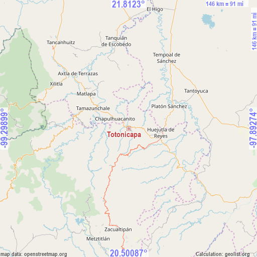
Totonicapa GPS coordinates[2]
21° 9' 28.944" North, 98° 35' 45.096" West
| Map corner | latitude | longitude |
|---|---|---|
| Upper-left | 21.8123°, | -99.29899° |
| Center: | 21.15804°, | -98.59586° |
| Lower-right: | 20.50087°, | -97.89274° |
| Map W x H: | 145.8×145.8 km | = 90.6×90.6mi |
| max Lat: | 32.7° ⇑21.3% North |
| Totonicapa: | 21.15804° |
| min Lat: | ⇓78.7% South 14.53588° |
| min Long | Totonicapa | max Long |
| -117.105° | -98.59586° | -86.73105° |
| W 56.1%⇐ | ⇒43.9% E |
Elevation
Elevation of Totonicapa is 195 m = 640 ft, and this is 1058.7 m = 3473 ft below average elevation for this country.
| Max E: |
3497 m = 11473 ft | 75.8% |
| Avg. | 1253.7 m = 4113 ft | |
| Totonicapa | 195 m = 640 ft | |
Min E: |
-1 m = -3 ft | 24.2% |
See also: Mexico elevation on elevation.city.
Geographical zone
Totonicapa is located in North Torrid zone (between Equator and Tropic of Cancer). Distance of this Northern Tropic circle is 253.4 km =157.5 mi to North.| Distance of | km | miles | from Totonicapa |
|---|---|---|---|
| North Pole | 7654.5 | 4756.3 | to North |
| Arctic Circle | 5048.6 | 3137.1 | to North |
| Tropic Cancer | 253.4 | 157.5 | to North |
| Equator | 2352.6 | 1461.8 | to South |


Nearby cities:
15 places around Totonicapa: (largest is in red/bold)
• Ahuatitla
7.3 km =4.5 mi,  276°
276°
• Chapulhuacanito
9.6 km =6 mi,  306°
306°
• Coacuilco
6.1 km =3.8 mi,  170°
170°
• Cochiscuatitla
7.1 km =4.4 mi,  41°
41°
• Cuapaxtitla
5.3 km =3.3 mi,  121°
121°
• Cuatlimax
9.6 km =6 mi,  225°
225°
• Huitzitzilingo
6.5 km =4 mi, 284°
• Ixcatépec
10.2 km =6.3 mi,  128°
128°
• Jaltocan
6.5 km =4 mi, 115°
• La Capilla
7.4 km =4.6 mi,  95°
95°
• Las Chacas
9.4 km =5.8 mi,  51°
51°
• Pueblo Hidalgo
9.8 km =6.1 mi,  240°
240°
• San Felipe Orizatlán
1.9 km =1.2 mi,  320°
320°
• San José
9.9 km =6.2 mi,  179°
179°
• Talol
5.3 km =3.3 mi,  217°
217°
Sources, notices
• [Note1] Compared only with cities in Mexico existing in our database
• [Src1] Map data: © OpenStreetMap contributors (CC-BY-SA)
• [Src2] Other city data from geonames.org with taken over terms of usage.
• [Src3] Geographical zone / Annual Mean Temperature by Robert A. Rohde @ Wikipedia
