Pilchatipa geodata
Pilchatipa (Hidalgo) is a populated place; located in Mexico in America/Mexico_City (GMT-6) time zone. With population of 695 people, there are 12521 cities with bigger population in this country. Compared to other cities in Mexico, 76.9% of cities are located further ↓South; 57.7% of cities are located further ←West and 66.4% of cities have higher elevation than Pilchatipa. Note1


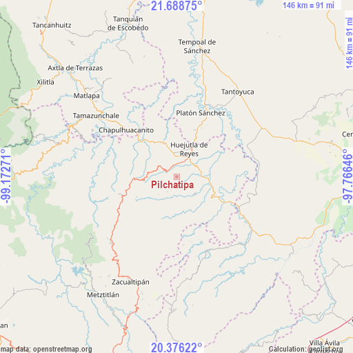
Pilchatipa GPS coordinates[2]
21° 2' 2.148" North, 98° 28' 10.488" West
| Map corner | latitude | longitude |
|---|---|---|
| Upper-left | 21.68875°, | -99.17271° |
| Center: | 21.03393°, | -98.46958° |
| Lower-right: | 20.37622°, | -97.76646° |
| Map W x H: | 145.9×145.9 km | = 90.7×90.7mi |
| max Lat: | 32.7° ⇑23.1% North |
| Pilchatipa: | 21.03393° |
| min Lat: | ⇓76.9% South 14.53588° |
| min Long | Pilchatipa | max Long |
| -117.105° | -98.46958° | -86.73105° |
| W 57.7%⇐ | ⇒42.3% E |
Elevation
Elevation of Pilchatipa is 619 m = 2031 ft, and this is 634.7 m = 2082 ft below average elevation for this country.
| Max E: |
3497 m = 11473 ft | 66.4% |
| Avg. | 1253.7 m = 4113 ft | |
| Pilchatipa | 619 m = 2031 ft | |
Min E: |
-1 m = -3 ft | 33.6% |
See also: Mexico elevation on elevation.city.
Geographical zone
Pilchatipa is located in North Torrid zone (between Equator and Tropic of Cancer). Distance of this Northern Tropic circle is 267.2 km =166 mi to North.| Distance of | km | miles | from Pilchatipa |
|---|---|---|---|
| North Pole | 7668.3 | 4764.9 | to North |
| Arctic Circle | 5062.4 | 3145.6 | to North |
| Tropic Cancer | 267.2 | 166 | to North |
| Equator | 2338.8 | 1453.3 | to South |


Nearby cities:
15 places around Pilchatipa: (largest is in red/bold)
• Acuatempa
4.1 km =2.5 mi,  357°
357°
• Aquixcuatitla
8.3 km =5.2 mi, 358°
• Atalco
6.9 km =4.3 mi,  24°
24°
• Axcaco
8.4 km =5.2 mi,  298°
298°
• Chatipán
6.2 km =3.9 mi,  255°
255°
• Huazalingo
7.1 km =4.4 mi,  213°
213°
• Ixcatlán
8.6 km =5.3 mi,  307°
307°
• La Mesa de Limatitla
6.8 km =4.2 mi,  48°
48°
• Machetla
3.8 km =2.4 mi,  317°
317°
• Pahuatlán
4 km =2.5 mi,  349°
349°
• San Francisco
2.5 km =1.6 mi,  225°
225°
• San Isidro
4.3 km =2.7 mi,  113°
113°
• Santo Tomás
5.5 km =3.4 mi,  161°
161°
• Tehuetlán
4.6 km =2.9 mi, 298°
• Xiquila
5.6 km =3.5 mi,  29°
29°
Sources, notices
• [Note1] Compared only with cities in Mexico existing in our database
• [Src1] Map data: © OpenStreetMap contributors (CC-BY-SA)
• [Src2] Other city data from geonames.org with taken over terms of usage.
• [Src3] Geographical zone / Annual Mean Temperature by Robert A. Rohde @ Wikipedia
