Huitzotlaco geodata
Huitzotlaco (Hidalgo) is a populated place; located in Mexico in America/Mexico_City (GMT-6) time zone. With population of 585 people, there are 14661 cities with bigger population in this country. Compared to other cities in Mexico, 77% of cities are located further ↓South; 58.9% of cities are located further ←West and 76.3% of cities have higher elevation than Huitzotlaco. Note1


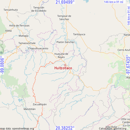
Huitzotlaco GPS coordinates[2]
21° 2' 24.72" North, 98° 22' 38.892" West
| Map corner | latitude | longitude |
|---|---|---|
| Upper-left | 21.69499°, | -99.0806° |
| Center: | 21.0402°, | -98.37747° |
| Lower-right: | 20.38252°, | -97.67435° |
| Map W x H: | 145.9×145.9 km | = 90.7×90.7mi |
| max Lat: | 32.7° ⇑23% North |
| Huitzotlaco: | 21.0402° |
| min Lat: | ⇓77% South 14.53588° |
| min Long | Huitzotlaco | max Long |
| -117.105° | -98.37747° | -86.73105° |
| W 58.9%⇐ | ⇒41.1% E |
Elevation
Elevation of Huitzotlaco is 176 m = 577 ft, and this is 1077.7 m = 3536 ft below average elevation for this country.
| Max E: |
3497 m = 11473 ft | 76.3% |
| Avg. | 1253.7 m = 4113 ft | |
| Huitzotlaco | 176 m = 577 ft | |
Min E: |
-1 m = -3 ft | 23.7% |
See also: Mexico elevation on elevation.city.
Geographical zone
Huitzotlaco is located in North Torrid zone (between Equator and Tropic of Cancer). Distance of this Northern Tropic circle is 266.5 km =165.6 mi to North.| Distance of | km | miles | from Huitzotlaco |
|---|---|---|---|
| North Pole | 7667.6 | 4764.4 | to North |
| Arctic Circle | 5061.7 | 3145.2 | to North |
| Tropic Cancer | 266.5 | 165.6 | to North |
| Equator | 2339.5 | 1453.7 | to South |


Nearby cities:
15 places around Huitzotlaco: (largest is in red/bold)
• Achiquihuixtla
6.6 km =4.1 mi,  170°
170°
• Ahuatempa
6.6 km =4.1 mi,  354°
354°
• Atlapexco
3.9 km =2.4 mi,  126°
126°
• La Candelaria
5.7 km =3.5 mi,  330°
330°
• La Mesa de Limatitla
5.9 km =3.7 mi,  310°
310°
• Los Puentes
6.8 km =4.2 mi,  90°
90°
• Pahactla
7.6 km =4.7 mi,  163°
163°
• San Isidro
6.1 km =3.8 mi,  246°
246°
• Santa Catarina
6.7 km =4.2 mi,  357°
357°
• Tecolotitla
4.1 km =2.5 mi, 159°
• Tenexco II
3.9 km =2.4 mi,  44°
44°
• Tepetitla
8.8 km =5.5 mi,  184°
184°
• Tlacuapan
7.2 km =4.5 mi, 85°
• Tlalchiyahualica
8 km =5 mi,  196°
196°
• Xiquila
8 km =5 mi,  301°
301°
Sources, notices
• [Note1] Compared only with cities in Mexico existing in our database
• [Src1] Map data: © OpenStreetMap contributors (CC-BY-SA)
• [Src2] Other city data from geonames.org with taken over terms of usage.
• [Src3] Geographical zone / Annual Mean Temperature by Robert A. Rohde @ Wikipedia
