Tenexco II geodata
Tenexco II (Hidalgo) is a populated place; located in Mexico in America/Mexico_City (GMT-6) time zone. With population of 532 people, there are 15923 cities with bigger population in this country. Compared to other cities in Mexico, 77.4% of cities are located further ↓South; 59.2% of cities are located further ←West and 73.6% of cities have higher elevation than Tenexco II. Note1


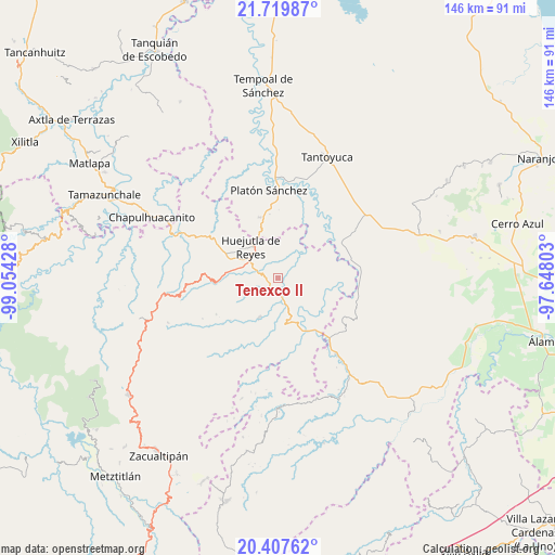
Tenexco II GPS coordinates[2]
21° 3' 54.684" North, 98° 21' 4.14" West
| Map corner | latitude | longitude |
|---|---|---|
| Upper-left | 21.71987°, | -99.05428° |
| Center: | 21.06519°, | -98.35115° |
| Lower-right: | 20.40762°, | -97.64803° |
| Map W x H: | 145.9×145.9 km | = 90.7×90.7mi |
| max Lat: | 32.7° ⇑22.6% North |
| Tenexco II: | 21.06519° |
| min Lat: | ⇓77.4% South 14.53588° |
| min Long | Tenexco II | max Long |
| -117.105° | -98.35115° | -86.73105° |
| W 59.2%⇐ | ⇒40.8% E |
Elevation
Elevation of Tenexco II is 269 m = 883 ft, and this is 984.7 m = 3231 ft below average elevation for this country.
| Max E: |
3497 m = 11473 ft | 73.6% |
| Avg. | 1253.7 m = 4113 ft | |
| Tenexco II | 269 m = 883 ft | |
Min E: |
-1 m = -3 ft | 26.4% |
See also: Mexico elevation on elevation.city.
Geographical zone
Tenexco II is located in North Torrid zone (between Equator and Tropic of Cancer). Distance of this Northern Tropic circle is 263.7 km =163.9 mi to North.| Distance of | km | miles | from Tenexco II |
|---|---|---|---|
| North Pole | 7664.8 | 4762.7 | to North |
| Arctic Circle | 5058.9 | 3143.5 | to North |
| Tropic Cancer | 263.7 | 163.9 | to North |
| Equator | 2342.2 | 1455.4 | to South |


Nearby cities:
15 places around Tenexco II: (largest is in red/bold)
• Achiquihuixtla
9.4 km =5.8 mi,  190°
190°
• Ahuatempa
5 km =3.1 mi,  318°
318°
• Ahuehuetl
7.2 km =4.5 mi,  105°
105°
• Atlapexco
5.1 km =3.2 mi,  175°
175°
• Chalahuiyapa
9.6 km =6 mi,  351°
351°
• Congreso Permanente Agrario
9.5 km =5.9 mi,  35°
35°
• Huautla
7.7 km =4.8 mi,  119°
119°
• Huitzotlaco
3.9 km =2.4 mi,  224°
224°
• La Candelaria
5.9 km =3.7 mi,  291°
291°
• La Mesa de Limatitla
7.3 km =4.5 mi,  278°
278°
• Los Otates
9.5 km =5.9 mi,  3°
3°
• Los Puentes
4.9 km =3 mi, 124°
• Santa Catarina
5 km =3.1 mi, 321°
• Tecolotitla
6.8 km =4.2 mi, 190°
• Tlacuapan
5 km =3.1 mi, 116°
Sources, notices
• [Note1] Compared only with cities in Mexico existing in our database
• [Src1] Map data: © OpenStreetMap contributors (CC-BY-SA)
• [Src2] Other city data from geonames.org with taken over terms of usage.
• [Src3] Geographical zone / Annual Mean Temperature by Robert A. Rohde @ Wikipedia
