La Candelaria geodata
La Candelaria (Hidalgo) is a populated place; located in Mexico in America/Mexico_City (GMT-6) time zone. With population of 882 people, there are 9904 cities with bigger population in this country. Compared to other cities in Mexico, 77.6% of cities are located further ↓South; 58.5% of cities are located further ←West and 75.8% of cities have higher elevation than La Candelaria. Note1


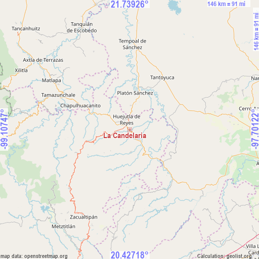
La Candelaria GPS coordinates[2]
21° 5' 4.812" North, 98° 24' 15.624" West
| Map corner | latitude | longitude |
|---|---|---|
| Upper-left | 21.73926°, | -99.10747° |
| Center: | 21.08467°, | -98.40434° |
| Lower-right: | 20.42718°, | -97.70122° |
| Map W x H: | 145.9×145.9 km | = 90.7×90.7mi |
| max Lat: | 32.7° ⇑22.4% North |
| La Candelaria: | 21.08467° |
| min Lat: | ⇓77.6% South 14.53588° |
| min Long | La Candelaria | max Long |
| -117.105° | -98.40434° | -86.73105° |
| W 58.5%⇐ | ⇒41.5% E |
Elevation
Elevation of La Candelaria is 197 m = 646 ft, and this is 1056.7 m = 3467 ft below average elevation for this country.
| Max E: |
3497 m = 11473 ft | 75.8% |
| Avg. | 1253.7 m = 4113 ft | |
| La Candelaria | 197 m = 646 ft | |
Min E: |
-1 m = -3 ft | 24.2% |
See also: Mexico elevation on elevation.city.
Geographical zone
La Candelaria is located in North Torrid zone (between Equator and Tropic of Cancer). Distance of this Northern Tropic circle is 261.5 km =162.5 mi to North.| Distance of | km | miles | from La Candelaria |
|---|---|---|---|
| North Pole | 7662.7 | 4761.4 | to North |
| Arctic Circle | 5056.8 | 3142.1 | to North |
| Tropic Cancer | 261.5 | 162.5 | to North |
| Equator | 2344.4 | 1456.7 | to South |


Nearby cities:
15 places around La Candelaria: (largest is in red/bold)
• Acuatempa
7.1 km =4.4 mi,  257°
257°
• Aguacatitla
5.5 km =3.4 mi,  304°
304°
• Ahuatempa
2.7 km =1.7 mi,  54°
54°
• Aquixcuatitla
7.5 km =4.7 mi,  290°
290°
• Atalco
4 km =2.5 mi,  279°
279°
• Chililico
6.4 km =4 mi,  329°
329°
• Huejutla de Reyes
6.3 km =3.9 mi,  345°
345°
• Huitzotlaco
5.7 km =3.5 mi,  150°
150°
• La Curva Tlaltzintla
7 km =4.3 mi,  314°
314°
• La Mesa de Limatitla
2 km =1.2 mi,  237°
237°
• Santa Catarina
3 km =1.9 mi, 54°
• Tenexco II
5.9 km =3.7 mi,  111°
111°
• Tepexititla
6.9 km =4.3 mi,  319°
319°
• Xiquila
4.1 km =2.5 mi, 259°
• Zapotitla
6.7 km =4.2 mi, 320°
Sources, notices
• [Note1] Compared only with cities in Mexico existing in our database
• [Src1] Map data: © OpenStreetMap contributors (CC-BY-SA)
• [Src2] Other city data from geonames.org with taken over terms of usage.
• [Src3] Geographical zone / Annual Mean Temperature by Robert A. Rohde @ Wikipedia
