San Pablo el Grande geodata
San Pablo el Grande (Hidalgo) is a populated place; located in Mexico in America/Mexico_City (GMT-6) time zone. With population of 1,053 people, there are 8288 cities with bigger population in this country. Compared to other cities in Mexico, 64.8% of cities are located further ↓South; 61.8% of cities are located further ←West and 58.6% of cities have lower elevation than San Pablo el Grande. Note1


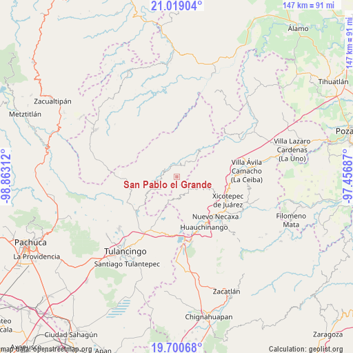
San Pablo el Grande GPS coordinates[2]
20° 21' 40.572" North, 98° 9' 35.964" West
| Map corner | latitude | longitude |
|---|---|---|
| Upper-left | 21.01904°, | -98.86312° |
| Center: | 20.36127°, | -98.15999° |
| Lower-right: | 19.70068°, | -97.45687° |
| Map W x H: | 146.6×146.6 km | = 91.1×91.1mi |
| max Lat: | 32.7° ⇑35.2% North |
| San Pablo el Grande: | 20.36127° |
| min Lat: | ⇓64.8% South 14.53588° |
| min Long | San Pablo el Gr | max Long |
| -117.105° | -98.15999° | -86.73105° |
| W 61.8%⇐ | ⇒38.2% E |
Elevation
Elevation of San Pablo el Grande is 1700 m = 5577 ft, and this is 446.3 m = 1464 ft above average elevation for this country.
| Max E: |
3497 m = 11473 ft | 41.4% |
| San Pablo el Grande | 1700 m 5577 ft | |
| Avg. | 1253.7 m = 4113 ft | |
Min E: |
-1 m = -3 ft | 58.6% |
See also: Mexico elevation on elevation.city.
Geographical zone
San Pablo el Grande is located in North Torrid zone (between Equator and Tropic of Cancer). Distance of this Northern Tropic circle is 342 km =212.5 mi to North.| Distance of | km | miles | from San Pablo el Grande |
|---|---|---|---|
| North Pole | 7743.1 | 4811.3 | to North |
| Arctic Circle | 5137.2 | 3192.1 | to North |
| Tropic Cancer | 342 | 212.5 | to North |
| Equator | 2264 | 1406.8 | to South |


Nearby cities:
15 places around San Pablo el Grande: (largest is in red/bold)
• Colonia Industrial
6.2 km =3.9 mi,  322°
322°
• Colonia San José
7.8 km =4.8 mi,  249°
249°
• Cuauneutla de la Paz
7.9 km =4.9 mi,  131°
131°
• El Damo
7.4 km =4.6 mi,  239°
239°
• El Ocotal
8 km =5 mi,  59°
59°
• Paciotla
7.5 km =4.7 mi,  165°
165°
• San Bartolo Tutotepec
5.9 km =3.7 mi,  314°
314°
• San Clemente
5 km =3.1 mi,  15°
15°
• San Nicolás
5.2 km =3.2 mi,  213°
213°
• San Pablito
6.7 km =4.2 mi,  181°
181°
• Santa María Temaxcalapa
4.5 km =2.8 mi,  297°
297°
• Tenango de Doria
7.5 km =4.7 mi, 250°
• Valle Verde
5.8 km =3.6 mi, 320°
• Xochimilco
6 km =3.7 mi, 173°
• Zoyatla de Guerrero
7.4 km =4.6 mi,  154°
154°
Sources, notices
• [Note1] Compared only with cities in Mexico existing in our database
• [Src1] Map data: © OpenStreetMap contributors (CC-BY-SA)
• [Src2] Other city data from geonames.org with taken over terms of usage.
• [Src3] Geographical zone / Annual Mean Temperature by Robert A. Rohde @ Wikipedia
