Paciotla geodata
Paciotla (Puebla) is a populated place; located in Mexico in America/Mexico_City (GMT-6) time zone. With population of 572 people, there are 14957 cities with bigger population in this country. Compared to other cities in Mexico, 63.4% of cities are located further ↓South; 62% of cities are located further ←West and 62.5% of cities have higher elevation than Paciotla. Note1


Paciotla GPS coordinates[2]
20° 17' 46.032" North, 98° 8' 32.928" West
| Map corner | latitude | longitude |
|---|---|---|
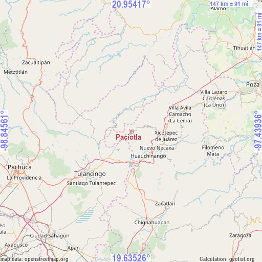
| Upper-left | 20.95417°, | -98.84561° |
| Center: | 20.29612°, | -98.14248° |
| Lower-right: | 19.63526°, | -97.43936° |
| Map W x H: | 146.6×146.7 km | = 91.1×91.2mi |
| max Lat: | 32.7° ⇑36.6% North |
| Paciotla: | 20.29612° |
| min Lat: | ⇓63.4% South 14.53588° |
| min Long | Paciotla | max Long |
| -117.105° | -98.14248° | -86.73105° |
| W 62%⇐ | ⇒38% E |
Elevation
Elevation of Paciotla is 854 m = 2802 ft, and this is 399.7 m = 1311 ft below average elevation for this country.
| Max E: |
3497 m = 11473 ft | 62.5% |
| Avg. | 1253.7 m = 4113 ft | |
| Paciotla | 854 m = 2802 ft | |
Min E: |
-1 m = -3 ft | 37.5% |
See also: Mexico elevation on elevation.city.
Geographical zone
Paciotla is located in North Torrid zone (between Equator and Tropic of Cancer). Distance of this Northern Tropic circle is 349.2 km =217 mi to North.| Distance of | km | miles | from Paciotla |
|---|---|---|---|
| North Pole | 7750.3 | 4815.8 | to North |
| Arctic Circle | 5144.5 | 3196.6 | to North |
| Tropic Cancer | 349.2 | 217 | to North |
| Equator | 2256.7 | 1402.2 | to South |


Nearby cities:
15 places around Paciotla: (largest is in red/bold)
• Acalapa
5.6 km =3.5 mi,  68°
68°
• Atla
3 km =1.9 mi,  141°
141°
• Atlantongo
4.3 km =2.7 mi, 144°
• Chila de Juárez
7.2 km =4.5 mi,  256°
256°
• Copila
6.7 km =4.2 mi,  112°
112°
• Cuauneutla de la Paz
4.6 km =2.9 mi,  63°
63°
• Cueyatla
6.2 km =3.9 mi,  94°
94°
• Icxotitla
7.4 km =4.6 mi, 143°
• Pahuatlán de Valle
2.2 km =1.4 mi,  201°
201°
• San Nicolás
5.5 km =3.4 mi,  301°
301°
• San Pablito
2.1 km =1.3 mi,  284°
284°
• Tlalcruz de Libres
3.3 km =2.1 mi, 74°
• Xochimilco
1.8 km =1.1 mi,  317°
317°
• Xolotla
4.3 km =2.7 mi,  167°
167°
• Zoyatla de Guerrero
1.5 km =0.9 mi, 67°
Sources, notices
• [Note1] Compared only with cities in Mexico existing in our database
• [Src1] Map data: © OpenStreetMap contributors (CC-BY-SA)
• [Src2] Other city data from geonames.org with taken over terms of usage.
• [Src3] Geographical zone / Annual Mean Temperature by Robert A. Rohde @ Wikipedia
