San Pablito geodata
San Pablito (Puebla) is a populated place; located in Mexico in America/Mexico_City (GMT-6) time zone. With population of 3,178 people, there are 2840 cities with bigger population in this country. Compared to other cities in Mexico, 63.5% of cities are located further ↓South; 61.8% of cities are located further ←West and 55.4% of cities have higher elevation than San Pablito. Note1


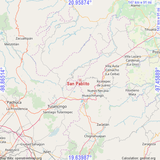
San Pablito GPS coordinates[2]
20° 18' 2.556" North, 98° 9' 43.236" West
| Map corner | latitude | longitude |
|---|---|---|
| Upper-left | 20.95874°, | -98.86514° |
| Center: | 20.30071°, | -98.16201° |
| Lower-right: | 19.63987°, | -97.45889° |
| Map W x H: | 146.6×146.6 km | = 91.1×91.1mi |
| max Lat: | 32.7° ⇑36.5% North |
| San Pablito: | 20.30071° |
| min Lat: | ⇓63.5% South 14.53588° |
| min Long | San Pablito | max Long |
| -117.105° | -98.16201° | -86.73105° |
| W 61.8%⇐ | ⇒38.2% E |
Elevation
Elevation of San Pablito is 1183 m = 3881 ft, and this is 70.7 m = 232 ft below average elevation for this country.
| Max E: |
3497 m = 11473 ft | 55.4% |
| Avg. | 1253.7 m = 4113 ft | |
| San Pablito | 1183 m = 3881 ft | |
Min E: |
-1 m = -3 ft | 44.6% |
See also: Mexico elevation on elevation.city.
Geographical zone
San Pablito is located in North Torrid zone (between Equator and Tropic of Cancer). Distance of this Northern Tropic circle is 348.7 km =216.7 mi to North.| Distance of | km | miles | from San Pablito |
|---|---|---|---|
| North Pole | 7749.8 | 4815.5 | to North |
| Arctic Circle | 5143.9 | 3196.3 | to North |
| Tropic Cancer | 348.7 | 216.7 | to North |
| Equator | 2257.2 | 1402.6 | to South |


Nearby cities:
15 places around San Pablito: (largest is in red/bold)
• Acalapa
7.4 km =4.6 mi,  77°
77°
• Atla
4.8 km =3 mi,  126°
126°
• Atlantongo
6 km =3.7 mi, 131°
• Chila de Juárez
5.4 km =3.4 mi,  246°
246°
• Cuauneutla de la Paz
6.4 km =4 mi, 76°
• El Damo
6.8 km =4.2 mi,  296°
296°
• Paciotla
2.1 km =1.3 mi,  104°
104°
• Pahuatlán de Valle
2.8 km =1.7 mi,  153°
153°
• San Nicolás
3.6 km =2.2 mi,  311°
311°
• San Pablo el Grande
6.7 km =4.2 mi,  1°
1°
• Santa Mónica
5.9 km =3.7 mi,  278°
278°
• Tlalcruz de Libres
5.2 km =3.2 mi,  85°
85°
• Xochimilco
1.2 km =0.7 mi,  46°
46°
• Xolotla
5.6 km =3.5 mi, 147°
• Zoyatla de Guerrero
3.4 km =2.1 mi, 88°
Sources, notices
• [Note1] Compared only with cities in Mexico existing in our database
• [Src1] Map data: © OpenStreetMap contributors (CC-BY-SA)
• [Src2] Other city data from geonames.org with taken over terms of usage.
• [Src3] Geographical zone / Annual Mean Temperature by Robert A. Rohde @ Wikipedia
