Guadalupe Victoria geodata
Guadalupe Victoria (Hidalgo) is a populated place; located in Mexico in America/Mexico_City (GMT-6) time zone. With population of 2,194 people, there are 4007 cities with bigger population in this country. Compared to other cities in Mexico, 57.8% of cities are located further ↓South; 60.3% of cities are located further ←West and 86.2% of cities have lower elevation than Guadalupe Victoria. Note1


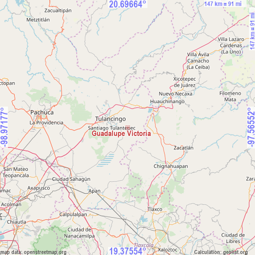
Guadalupe Victoria GPS coordinates[2]
20° 2' 14.928" North, 98° 16' 7.104" West
| Map corner | latitude | longitude |
|---|---|---|
| Upper-left | 20.69664°, | -98.97177° |
| Center: | 20.03748°, | -98.26864° |
| Lower-right: | 19.37554°, | -97.56552° |
| Map W x H: | 146.9×146.9 km | = 91.3×91.3mi |
| max Lat: | 32.7° ⇑42.2% North |
| Guadalupe Victoria: | 20.03748° |
| min Lat: | ⇓57.8% South 14.53588° |
| min Long | Guadalupe Victo | max Long |
| -117.105° | -98.26864° | -86.73105° |
| W 60.3%⇐ | ⇒39.7% E |
Elevation
Elevation of Guadalupe Victoria is 2287 m = 7503 ft, and this is 1033.3 m = 3390 ft above average elevation for this country.
| Max E: |
3497 m = 11473 ft | 13.8% |
| Guadalupe Victoria | 2287 m 7503 ft | |
| Avg. | 1253.7 m = 4113 ft | |
Min E: |
-1 m = -3 ft | 86.2% |
See also: Mexico elevation on elevation.city.
Geographical zone
Guadalupe Victoria is located in North Torrid zone (between Equator and Tropic of Cancer). Distance of this Northern Tropic circle is 378 km =234.9 mi to North.| Distance of | km | miles | from Guadalupe Victoria |
|---|---|---|---|
| North Pole | 7779.1 | 4833.7 | to North |
| Arctic Circle | 5173.2 | 3214.5 | to North |
| Tropic Cancer | 378 | 234.9 | to North |
| Equator | 2228 | 1384.4 | to South |


Nearby cities:
15 places around Guadalupe Victoria: (largest is in red/bold)
• Almoloya
5.3 km =3.3 mi,  251°
251°
• Buenos Aires
3 km =1.9 mi,  234°
234°
• Cerro Verde
3.3 km =2.1 mi,  307°
307°
• Cuautepec de Hinojosa
4.3 km =2.7 mi,  267°
267°
• El Capulín
3.3 km =2.1 mi,  193°
193°
• El Tepeyac
4.6 km =2.9 mi,  288°
288°
• Hueyapita
4.7 km =2.9 mi,  37°
37°
• Loma Bonita
4.5 km =2.8 mi,  298°
298°
• San Juan Hueyapan
1.6 km =1 mi,  239°
239°
• San Lorenzo Sayula
6.2 km =3.9 mi,  209°
209°
• Santa Elena Paliseca
5.2 km =3.2 mi,  147°
147°
• Santa María Nativitas
2.8 km =1.7 mi, 273°
• Texcaltepec
5.9 km =3.7 mi,  262°
262°
• Tezoquipa
7 km =4.3 mi, 266°
• Ventoquipa
7.2 km =4.5 mi, 266°
Sources, notices
• [Note1] Compared only with cities in Mexico existing in our database
• [Src1] Map data: © OpenStreetMap contributors (CC-BY-SA)
• [Src2] Other city data from geonames.org with taken over terms of usage.
• [Src3] Geographical zone / Annual Mean Temperature by Robert A. Rohde @ Wikipedia
