San Pedro Tlacotepec geodata
San Pedro Tlacotepec (Tlaxcala) is a populated place; located in Mexico in America/Mexico_City (GMT-6) time zone. With population of 3,523 people, there are 2589 cities with bigger population in this country. Compared to other cities in Mexico, 56.4% of cities are located further ↑North; 63.1% of cities are located further ←West and 92.7% of cities have lower elevation than San Pedro Tlacotepec. Note1
Current local time in San Pedro Tlacotepec:
06:49 AM, WednesdayDifference from your time zone: hours


San Pedro Tlacotepec GPS coordinates[2]
19° 23' 44.844" North, 98° 2' 45.204" West
| Map corner | latitude | longitude |
|---|---|---|
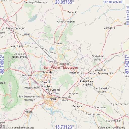
| Upper-left | 20.05765°, | -98.74902° |
| Center: | 19.39579°, | -98.04589° |
| Lower-right: | 18.73123°, | -97.34277° |
| Map W x H: | 147.5×147.5 km | = 91.7×91.7mi |
| max Lat: | 32.7° ⇑56.4% North |
| San Pedro Tlacotepec: | 19.39579° |
| min Lat: | ⇓43.6% South 14.53588° |
| min Long | San Pedro Tlaco | max Long |
| -117.105° | -98.04589° | -86.73105° |
| W 63.1%⇐ | ⇒36.9% E |
Elevation
Elevation of San Pedro Tlacotepec is 2517 m = 8258 ft, and this is 1263.3 m = 4145 ft above average elevation for this country.
| Max E: |
3497 m = 11473 ft | 7.3% |
| San Pedro Tlacotepec | 2517 m 8258 ft | |
| Avg. | 1253.7 m = 4113 ft | |
Min E: |
-1 m = -3 ft | 92.7% |
See also: Mexico elevation on elevation.city.
Geographical zone
San Pedro Tlacotepec is located in North Torrid zone (between Equator and Tropic of Cancer). Distance of this Northern Tropic circle is 449.3 km =279.2 mi to North.| Distance of | km | miles | from San Pedro Tlacotepec |
|---|---|---|---|
| North Pole | 7850.5 | 4878.1 | to North |
| Arctic Circle | 5244.6 | 3258.8 | to North |
| Tropic Cancer | 449.3 | 279.2 | to North |
| Equator | 2156.6 | 1340 | to South |


Nearby cities:
15 places around San Pedro Tlacotepec: (largest is in red/bold)
• Colonia José López Portillo
3.8 km =2.4 mi,  348°
348°
• Colonia Velazco
5 km =3.1 mi,  41°
41°
• Colonia Venustiano Carranza
1.4 km =0.9 mi,  290°
290°
• El Carmen Xalpatlahuaya
6.7 km =4.2 mi,  93°
93°
• Guadalupe Texcalac
5.8 km =3.6 mi,  324°
324°
• San Andrés Ahuashuatepec
6.7 km =4.2 mi,  253°
253°
• San José Teacalco
7 km =4.3 mi,  196°
196°
• San Juan Quetzalcoapan
3.2 km =2 mi,  235°
235°
• San Miguel Buenavista
5.5 km =3.4 mi,  213°
213°
• Santa Cruz Zacatzontetla
1.1 km =0.7 mi,  77°
77°
• Santa María Texcalac
5.3 km =3.3 mi,  305°
305°
• Tocatlán
2.1 km =1.3 mi,  112°
112°
• Tzompantepec
5.1 km =3.2 mi, 244°
• Xaloztoc
1.3 km =0.8 mi,  359°
359°
• Xaltianquisco
4.7 km =2.9 mi,  232°
232°
Sources, notices
• [Note1] Compared only with cities in Mexico existing in our database
• [Src1] Map data: © OpenStreetMap contributors (CC-BY-SA)
• [Src2] Other city data from geonames.org with taken over terms of usage.
• [Src3] Geographical zone / Annual Mean Temperature by Robert A. Rohde @ Wikipedia
