Nuevo Nicapa geodata
Nuevo Nicapa (Chiapas) is a populated place; located in Mexico in America/Mexico_City (GMT-6) time zone. With population of 1,346 people, there are 6464 cities with bigger population in this country. Compared to other cities in Mexico, 81.9% of cities are located further ↑North; 88.2% of cities are located further ←West and 92.1% of cities have higher elevation than Nuevo Nicapa. Note1


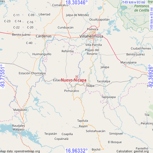
Nuevo Nicapa GPS coordinates[2]
17° 38' 4.704" North, 93° 4' 20.568" West
| Map corner | latitude | longitude |
|---|---|---|
| Upper-left | 18.30346°, | -93.77551° |
| Center: | 17.63464°, | -93.07238° |
| Lower-right: | 16.96332°, | -92.36926° |
| Map W x H: | 149×149 km | = 92.6×92.6mi |
| max Lat: | 32.7° ⇑81.9% North |
| Nuevo Nicapa: | 17.63464° |
| min Lat: | ⇓18.1% South 14.53588° |
| min Long | Nuevo Nicapa | max Long |
| -117.105° | -93.07238° | -86.73105° |
| W 88.2%⇐ | ⇒11.8% E |
Elevation
Elevation of Nuevo Nicapa is 19 m = 62 ft, and this is 1234.7 m = 4051 ft below average elevation for this country.
| Max E: |
3497 m = 11473 ft | 92.1% |
| Avg. | 1253.7 m = 4113 ft | |
| Nuevo Nicapa | 19 m = 62 ft | |
Min E: |
-1 m = -3 ft | 7.9% |
See also: Mexico elevation on elevation.city.
Geographical zone
Nuevo Nicapa is located in North Torrid zone (between Equator and Tropic of Cancer). Distance of this Northern Tropic circle is 645.1 km =400.8 mi to North.| Distance of | km | miles | from Nuevo Nicapa |
|---|---|---|---|
| North Pole | 8046.3 | 4999.7 | to North |
| Arctic Circle | 5440.4 | 3380.5 | to North |
| Tropic Cancer | 645.1 | 400.8 | to North |
| Equator | 1960.8 | 1218.4 | to South |


Nearby cities:
15 places around Nuevo Nicapa: (largest is in red/bold)
• Andrés Quintana Roo
10.4 km =6.5 mi,  38°
38°
• Chapultepec
13.1 km =8.1 mi,  126°
126°
• Colonia Municipal
10.9 km =6.8 mi,  115°
115°
• Colorado (Benito Juárez)
5.2 km =3.2 mi,  78°
78°
• Doctor Belisario Domínguez
8.9 km =5.5 mi,  247°
247°
• Hermenegildo Galeana
9.8 km =6.1 mi,  49°
49°
• Ignacio Allende 2da. Sección
12.8 km =8 mi,  135°
135°
• José María Morelos y Pavón (Las Delicias)
14.7 km =9.1 mi,  89°
89°
• Juan Aldama
5.5 km =3.4 mi, 120°
• Juárez
13.3 km =8.3 mi,  256°
256°
• Manuel Buelta 2da. Sección
13.1 km =8.1 mi, 118°
• Mariano Matamoros Segunda Sección
10.8 km =6.7 mi,  203°
203°
• Napana
13.9 km =8.6 mi,  192°
192°
• Pichucalco
14.6 km =9.1 mi, 198°
• Pueblo Juárez
9.3 km =5.8 mi,  276°
276°
Sources, notices
• [Note1] Compared only with cities in Mexico existing in our database
• [Src1] Map data: © OpenStreetMap contributors (CC-BY-SA)
• [Src2] Other city data from geonames.org with taken over terms of usage.
• [Src3] Geographical zone / Annual Mean Temperature by Robert A. Rohde @ Wikipedia
