Hermenegildo Galeana geodata
Hermenegildo Galeana (Tabasco) is a populated place; located in Mexico in America/Mexico_City (GMT-6) time zone. With population of 938 people, there are 9294 cities with bigger population in this country. Compared to other cities in Mexico, 81.4% of cities are located further ↑North; 88.6% of cities are located further ←West and 94% of cities have higher elevation than Hermenegildo Galeana. Note1
Current local time in Hermenegildo Galeana:
05:07 AM, WednesdayDifference from your time zone: hours


Hermenegildo Galeana GPS coordinates[2]
17° 41' 28.788" North, 93° 0' 6.876" West
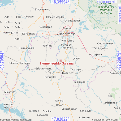
| Map corner | latitude | longitude |
|---|---|---|
| Upper-left | 18.35994°, | -93.70504° |
| Center: | 17.69133°, | -93.00191° |
| Lower-right: | 17.02022°, | -92.29879° |
| Map W x H: | 149×149 km | = 92.6×92.6mi |
| max Lat: | 32.7° ⇑81.4% North |
| Hermenegildo Galeana: | 17.69133° |
| min Lat: | ⇓18.6% South 14.53588° |
| min Long | Hermenegildo Ga | max Long |
| -117.105° | -93.00191° | -86.73105° |
| W 88.6%⇐ | ⇒11.4% E |
Elevation
Elevation of Hermenegildo Galeana is 15 m = 49 ft, and this is 1238.7 m = 4064 ft below average elevation for this country.
| Max E: |
3497 m = 11473 ft | 94% |
| Avg. | 1253.7 m = 4113 ft | |
| Hermenegildo Galeana | 15 m = 49 ft | |
Min E: |
-1 m = -3 ft | 6% |
See also: Mexico elevation on elevation.city.
Geographical zone
Hermenegildo Galeana is located in North Torrid zone (between Equator and Tropic of Cancer). Distance of this Northern Tropic circle is 638.8 km =396.9 mi to North.| Distance of | km | miles | from Hermenegildo Galeana |
|---|---|---|---|
| North Pole | 8040 | 4995.8 | to North |
| Arctic Circle | 5434.1 | 3376.6 | to North |
| Tropic Cancer | 638.8 | 396.9 | to North |
| Equator | 1967.1 | 1222.3 | to South |


Nearby cities:
15 places around Hermenegildo Galeana: (largest is in red/bold)
• Andrés Quintana Roo
2 km =1.2 mi,  332°
332°
• Chapultepec
14.4 km =8.9 mi,  167°
167°
• Colonia Municipal
11.3 km =7 mi, 168°
• Colorado (Benito Juárez)
5.7 km =3.5 mi,  204°
204°
• Hueso de Puerco
15.6 km =9.7 mi,  45°
45°
• Ignacio Allende 2da. Sección
15.5 km =9.6 mi, 174°
• José María Morelos y Pavón (Las Delicias)
9.4 km =5.8 mi,  130°
130°
• Juan Aldama
9.5 km =5.9 mi, 197°
• Manuel Buelta 2da. Sección
13.2 km =8.2 mi,  162°
162°
• Manuel Buelta y Rayón
5.3 km =3.3 mi,  73°
73°
• Mariano Abasolo
16.4 km =10.2 mi, 167°
• Nuevo Nicapa
9.8 km =6.1 mi,  229°
229°
• Nuevo Volcán Chichonal
14.5 km =9 mi,  308°
308°
• Río de Teapa
14.9 km =9.3 mi, 46°
• Santa Cruz Tepate Abajo
12.6 km =7.8 mi,  342°
342°
In other languages:
- In Spanish: Hermenegildo Galeana Tercera Sección, Hermenegildo Galeana, Tercera Sección
Sources, notices
• [Note1] Compared only with cities in Mexico existing in our database
• [Src1] Map data: © OpenStreetMap contributors (CC-BY-SA)
• [Src2] Other city data from geonames.org with taken over terms of usage.
• [Src3] Geographical zone / Annual Mean Temperature by Robert A. Rohde @ Wikipedia
