El Bascán (Lucha Bascán) geodata
El Bascán (Lucha Bascán) (Chiapas) is a populated place; located in Mexico in America/Mexico_City (GMT-6) time zone. With population of 553 people, there are 15422 cities with bigger population in this country. Compared to other cities in Mexico, 84.4% of cities are located further ↑North; 94.9% of cities are located further ←West and 79.8% of cities have higher elevation than El Bascán (Lucha Bascán). Note1
Current local time in El Bascán (Lucha Bascán):
06:55 AM, WednesdayDifference from your time zone: hours


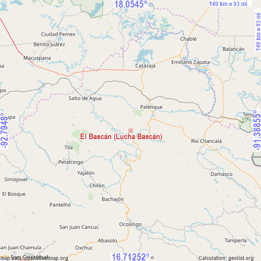
El Bascán (Lucha Bascán) GPS coordinates[2]
17° 23' 5.064" North, 92° 5' 30.012" West
| Map corner | latitude | longitude |
|---|---|---|
| Upper-left | 18.0545°, | -92.7948° |
| Center: | 17.38474°, | -92.09167° |
| Lower-right: | 16.71252°, | -91.38855° |
| Map W x H: | 149.2×149.2 km | = 92.7×92.7mi |
| max Lat: | 32.7° ⇑84.4% North |
| El Bascán (Lucha Bascán): | 17.38474° |
| min Lat: | ⇓15.6% South 14.53588° |
| min Long | El Bascán (Luc | max Long |
| -117.105° | -92.09167° | -86.73105° |
| W 94.9%⇐ | ⇒5.1% E |
Elevation
Elevation of El Bascán (Lucha Bascán) is 98 m = 322 ft, and this is 1155.7 m = 3792 ft below average elevation for this country.
| Max E: |
3497 m = 11473 ft | 79.8% |
| Avg. | 1253.7 m = 4113 ft | |
| El Bascán (Lucha Bascán) | 98 m = 322 ft | |
Min E: |
-1 m = -3 ft | 20.2% |
See also: Mexico elevation on elevation.city.
Geographical zone
El Bascán (Lucha Bascán) is located in North Torrid zone (between Equator and Tropic of Cancer). Distance of this Northern Tropic circle is 672.9 km =418.1 mi to North.| Distance of | km | miles | from El Bascán (Lucha Bascán) |
|---|---|---|---|
| North Pole | 8074.1 | 5017 | to North |
| Arctic Circle | 5468.2 | 3397.8 | to North |
| Tropic Cancer | 672.9 | 418.1 | to North |
| Equator | 1933 | 1201.1 | to South |


Nearby cities:
15 places around El Bascán (Lucha Bascán): (largest is in red/bold)
• Adolfo Ruiz Cortínes
11.6 km =7.2 mi,  89°
89°
• Arroyo Palenque
1.6 km =1 mi,  299°
299°
• Belisario Domínguez
11.7 km =7.3 mi,  78°
78°
• Chivaltic Nuevo
3.9 km =2.4 mi,  20°
20°
• El Naranjo
8.8 km =5.5 mi, 15°
• Francisco I. Madero
4.6 km =2.9 mi,  117°
117°
• Ignacio Zaragoza
7 km =4.3 mi,  65°
65°
• Jerusalén
3.8 km =2.4 mi, 119°
• Río Tulija
10.9 km =6.8 mi,  153°
153°
• San Miguel
9.2 km =5.7 mi,  105°
105°
• Santa María
3.9 km =2.4 mi,  156°
156°
• Suclumpa
8.2 km =5.1 mi,  291°
291°
• Tiemopa
12 km =7.5 mi, 292°
• Tioquipa el Bascán
5.5 km =3.4 mi,  269°
269°
• Vicente Guerrero
9.4 km =5.8 mi, 152°
Sources, notices
• [Note1] Compared only with cities in Mexico existing in our database
• [Src1] Map data: © OpenStreetMap contributors (CC-BY-SA)
• [Src2] Other city data from geonames.org with taken over terms of usage.
• [Src3] Geographical zone / Annual Mean Temperature by Robert A. Rohde @ Wikipedia
