Arroyo Palenque geodata
Arroyo Palenque (Chiapas) is a populated place; located in Mexico in America/Mexico_City (GMT-6) time zone. With population of 1,137 people, there are 7633 cities with bigger population in this country. Compared to other cities in Mexico, 84.3% of cities are located further ↑North; 94.8% of cities are located further ←West and 78.7% of cities have higher elevation than Arroyo Palenque. Note1


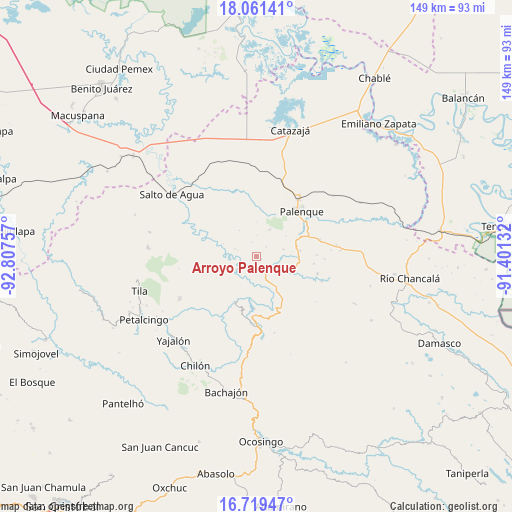
Arroyo Palenque GPS coordinates[2]
17° 23' 30.012" North, 92° 6' 15.984" West
| Map corner | latitude | longitude |
|---|---|---|
| Upper-left | 18.06141°, | -92.80757° |
| Center: | 17.39167°, | -92.10444° |
| Lower-right: | 16.71947°, | -91.40132° |
| Map W x H: | 149.2×149.2 km | = 92.7×92.7mi |
| max Lat: | 32.7° ⇑84.3% North |
| Arroyo Palenque: | 17.39167° |
| min Lat: | ⇓15.7% South 14.53588° |
| min Long | Arroyo Palenque | max Long |
| -117.105° | -92.10444° | -86.73105° |
| W 94.8%⇐ | ⇒5.2% E |
Elevation
Elevation of Arroyo Palenque is 116 m = 381 ft, and this is 1137.7 m = 3733 ft below average elevation for this country.
| Max E: |
3497 m = 11473 ft | 78.7% |
| Avg. | 1253.7 m = 4113 ft | |
| Arroyo Palenque | 116 m = 381 ft | |
Min E: |
-1 m = -3 ft | 21.3% |
See also: Mexico elevation on elevation.city.
Geographical zone
Arroyo Palenque is located in North Torrid zone (between Equator and Tropic of Cancer). Distance of this Northern Tropic circle is 672.1 km =417.6 mi to North.| Distance of | km | miles | from Arroyo Palenque |
|---|---|---|---|
| North Pole | 8073.3 | 5016.5 | to North |
| Arctic Circle | 5467.4 | 3397.3 | to North |
| Tropic Cancer | 672.1 | 417.6 | to North |
| Equator | 1933.8 | 1201.6 | to South |


Nearby cities:
15 places around Arroyo Palenque: (largest is in red/bold)
• Chivaltic Nuevo
3.9 km =2.4 mi,  43°
43°
• Cuctiepa
12.2 km =7.6 mi,  219°
219°
• El Bascán (Lucha Bascán)
1.6 km =1 mi,  119°
119°
• El Naranjo
8.6 km =5.3 mi,  25°
25°
• Francisco I. Madero
6.2 km =3.9 mi, 118°
• Ignacio Zaragoza
8 km =5 mi,  74°
74°
• Jerusalén
5.3 km =3.3 mi, 119°
• Río Tulija
12.2 km =7.6 mi,  149°
149°
• San Miguel
10.7 km =6.6 mi,  107°
107°
• San Pedro
11.7 km =7.3 mi,  272°
272°
• Santa María
5.3 km =3.3 mi, 146°
• Suclumpa
6.7 km =4.2 mi,  289°
289°
• Tiemopa
10.5 km =6.5 mi, 290°
• Tioquipa el Bascán
4.2 km =2.6 mi,  259°
259°
• Vicente Guerrero
10.7 km =6.6 mi, 148°
Sources, notices
• [Note1] Compared only with cities in Mexico existing in our database
• [Src1] Map data: © OpenStreetMap contributors (CC-BY-SA)
• [Src2] Other city data from geonames.org with taken over terms of usage.
• [Src3] Geographical zone / Annual Mean Temperature by Robert A. Rohde @ Wikipedia
