Arroyo Grande geodata
Arroyo Grande (Chiapas) is a populated place; located in Mexico in America/Mexico_City (GMT-6) time zone. With population of 1,172 people, there are 7412 cities with bigger population in this country. Compared to other cities in Mexico, 86.7% of cities are located further ↑North; 89.4% of cities are located further ←West and 61.9% of cities have lower elevation than Arroyo Grande. Note1


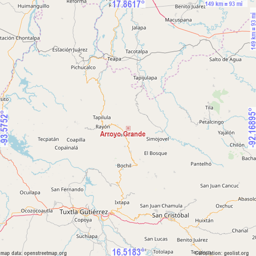
Arroyo Grande GPS coordinates[2]
17° 11' 28.392" North, 92° 52' 19.452" West
| Map corner | latitude | longitude |
|---|---|---|
| Upper-left | 17.8617°, | -93.5752° |
| Center: | 17.19122°, | -92.87207° |
| Lower-right: | 16.5183°, | -92.16895° |
| Map W x H: | 149.4×149.4 km | = 92.8×92.8mi |
| max Lat: | 32.7° ⇑86.7% North |
| Arroyo Grande: | 17.19122° |
| min Lat: | ⇓13.3% South 14.53588° |
| min Long | Arroyo Grande | max Long |
| -117.105° | -92.87207° | -86.73105° |
| W 89.4%⇐ | ⇒10.6% E |
Elevation
Elevation of Arroyo Grande is 1758 m = 5768 ft, and this is 504.3 m = 1655 ft above average elevation for this country.
| Max E: |
3497 m = 11473 ft | 38.1% |
| Arroyo Grande | 1758 m 5768 ft | |
| Avg. | 1253.7 m = 4113 ft | |
Min E: |
-1 m = -3 ft | 61.9% |
See also: Mexico elevation on elevation.city.
Geographical zone
Arroyo Grande is located in North Torrid zone (between Equator and Tropic of Cancer). Distance of this Northern Tropic circle is 694.4 km =431.5 mi to North.| Distance of | km | miles | from Arroyo Grande |
|---|---|---|---|
| North Pole | 8095.6 | 5030.4 | to North |
| Arctic Circle | 5489.7 | 3411.1 | to North |
| Tropic Cancer | 694.4 | 431.5 | to North |
| Equator | 1911.5 | 1187.8 | to South |


Nearby cities:
15 places around Arroyo Grande: (largest is in red/bold)
• Altamirano
11.7 km =7.3 mi,  138°
138°
• Aurora Ermita
5 km =3.1 mi,  357°
357°
• Año de Juárez
8.3 km =5.2 mi,  19°
19°
• El Pinabeto
9.4 km =5.8 mi,  280°
280°
• Guadalupe Victoria Dos
11.8 km =7.3 mi,  104°
104°
• La Florida
10.4 km =6.5 mi,  305°
305°
• Lázaro Cárdenas
3.7 km =2.3 mi,  91°
91°
• Maravillas
10.7 km =6.6 mi,  190°
190°
• Pueblo Nuevo
4.5 km =2.8 mi,  220°
220°
• Rincón Chamula
7.3 km =4.5 mi, 283°
• Rivera Galeana
11.9 km =7.4 mi,  127°
127°
• San Andrés Duraznal
9.7 km =6 mi, 132°
• San Rafael
9.5 km =5.9 mi,  83°
83°
• Sonora
4.4 km =2.7 mi,  118°
118°
• Zacatonal de Juárez
11.8 km =7.3 mi,  41°
41°
Sources, notices
• [Note1] Compared only with cities in Mexico existing in our database
• [Src1] Map data: © OpenStreetMap contributors (CC-BY-SA)
• [Src2] Other city data from geonames.org with taken over terms of usage.
• [Src3] Geographical zone / Annual Mean Temperature by Robert A. Rohde @ Wikipedia
