Plan de Ayala geodata
Plan de Ayala (Chiapas) is a populated place; located in Mexico in America/Mexico_City (GMT-6) time zone. With population of 662 people, there are 13120 cities with bigger population in this country. Compared to other cities in Mexico, 98.2% of cities are located further ↑North; 88.3% of cities are located further ←West and 70.7% of cities have higher elevation than Plan de Ayala. Note1


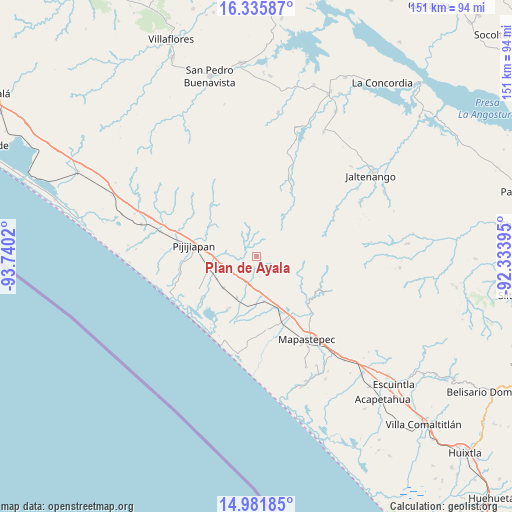
Plan de Ayala GPS coordinates[2]
15° 39' 35.928" North, 93° 2' 13.452" West
| Map corner | latitude | longitude |
|---|---|---|
| Upper-left | 16.33587°, | -93.7402° |
| Center: | 15.65998°, | -93.03707° |
| Lower-right: | 14.98185°, | -92.33395° |
| Map W x H: | 150.6×150.6 km | = 93.6×93.6mi |
| max Lat: | 32.7° ⇑98.2% North |
| Plan de Ayala: | 15.65998° |
| min Lat: | ⇓1.8% South 14.53588° |
| min Long | Plan de Ayala | max Long |
| -117.105° | -93.03707° | -86.73105° |
| W 88.3%⇐ | ⇒11.7% E |
Elevation
Elevation of Plan de Ayala is 381 m = 1250 ft, and this is 872.7 m = 2863 ft below average elevation for this country.
| Max E: |
3497 m = 11473 ft | 70.7% |
| Avg. | 1253.7 m = 4113 ft | |
| Plan de Ayala | 381 m = 1250 ft | |
Min E: |
-1 m = -3 ft | 29.3% |
See also: Mexico elevation on elevation.city.
Geographical zone
Plan de Ayala is located in North Torrid zone (between Equator and Tropic of Cancer). Distance of this Northern Tropic circle is 864.7 km =537.3 mi to North.| Distance of | km | miles | from Plan de Ayala |
|---|---|---|---|
| North Pole | 8265.8 | 5136.1 | to North |
| Arctic Circle | 5659.9 | 3516.9 | to North |
| Tropic Cancer | 864.7 | 537.3 | to North |
| Equator | 1741.2 | 1081.9 | to South |


Nearby cities:
15 places around Plan de Ayala: (largest is in red/bold)
• Adolfo López Mateos
21.8 km =13.5 mi,  172°
172°
• Doctor Samuel León Brindis
18.5 km =11.5 mi,  157°
157°
• El Carmen
13.6 km =8.5 mi,  226°
226°
• Guadalupe Victoria
24.1 km =15 mi,  135°
135°
• Guanajuato
12.8 km =8 mi,  263°
263°
• Hermenegildo Galeana
12.4 km =7.7 mi, 165°
• Joaquín Miguel Gutiérrez (Margaritas)
13.6 km =8.5 mi,  206°
206°
• Las Brisas
18.1 km =11.2 mi, 208°
• Miguel Alemán Valdez (Jericó)
13.3 km =8.3 mi, 170°
• Monterrey
16.7 km =10.4 mi,  68°
68°
• Nueva Coapa (Estación Echegaray)
14.4 km =8.9 mi,  254°
254°
• Nuevo Milenio Valdivia
19.9 km =12.4 mi,  151°
151°
• Pijijiapan
18.7 km =11.6 mi,  278°
278°
• Plan de la Libertad
20 km =12.4 mi,  51°
51°
• Progreso
13.4 km =8.3 mi,  239°
239°
Sources, notices
• [Note1] Compared only with cities in Mexico existing in our database
• [Src1] Map data: © OpenStreetMap contributors (CC-BY-SA)
• [Src2] Other city data from geonames.org with taken over terms of usage.
• [Src3] Geographical zone / Annual Mean Temperature by Robert A. Rohde @ Wikipedia
