Adolfo López Mateos geodata
Adolfo López Mateos (Chiapas) is a populated place; located in Mexico in America/Mexico_City (GMT-6) time zone. With population of 521 people, there are 16186 cities with bigger population in this country. Compared to other cities in Mexico, 98.6% of cities are located further ↑North; 88.5% of cities are located further ←West and 88% of cities have higher elevation than Adolfo López Mateos. Note1


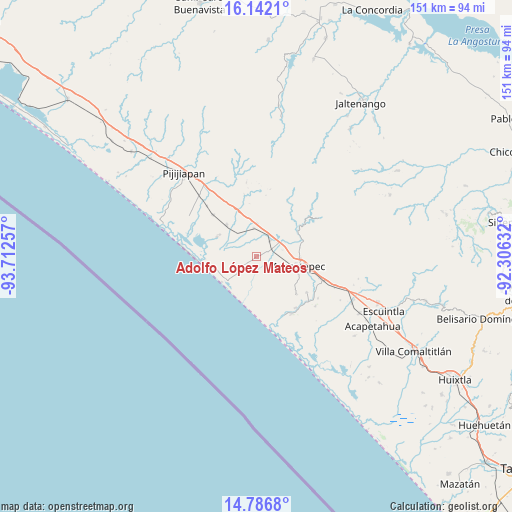
Adolfo López Mateos GPS coordinates[2]
15° 27' 56.016" North, 93° 0' 33.984" West
| Map corner | latitude | longitude |
|---|---|---|
| Upper-left | 16.1421°, | -93.71257° |
| Center: | 15.46556°, | -93.00944° |
| Lower-right: | 14.7868°, | -92.30632° |
| Map W x H: | 150.7×150.7 km | = 93.6×93.6mi |
| max Lat: | 32.7° ⇑98.6% North |
| Adolfo López Mateos: | 15.46556° |
| min Lat: | ⇓1.4% South 14.53588° |
| min Long | Adolfo López M | max Long |
| -117.105° | -93.00944° | -86.73105° |
| W 88.5%⇐ | ⇒11.5% E |
Elevation
Elevation of Adolfo López Mateos is 30 m = 98 ft, and this is 1223.7 m = 4015 ft below average elevation for this country.
| Max E: |
3497 m = 11473 ft | 88% |
| Avg. | 1253.7 m = 4113 ft | |
| Adolfo López Mateos | 30 m = 98 ft | |
Min E: |
-1 m = -3 ft | 12% |
See also: Mexico elevation on elevation.city.
Geographical zone
Adolfo López Mateos is located in North Torrid zone (between Equator and Tropic of Cancer). Distance of this Northern Tropic circle is 886.3 km =550.7 mi to North.| Distance of | km | miles | from Adolfo López Mateos |
|---|---|---|---|
| North Pole | 8287.5 | 5149.6 | to North |
| Arctic Circle | 5681.6 | 3530.4 | to North |
| Tropic Cancer | 886.3 | 550.7 | to North |
| Equator | 1719.6 | 1068.5 | to South |


Nearby cities:
15 places around Adolfo López Mateos: (largest is in red/bold)
• Abraham González
16.2 km =10.1 mi,  133°
133°
• Doctor Samuel León Brindis
6.1 km =3.8 mi,  41°
41°
• El Carmen
17.7 km =11 mi,  313°
313°
• Flores Magón
19.6 km =12.2 mi,  108°
108°
• Generación 2000 Nuevo Milenio
12.4 km =7.7 mi,  89°
89°
• Guadalupe Victoria
14.6 km =9.1 mi,  72°
72°
• Hermenegildo Galeana
9.7 km =6 mi,  0°
0°
• Joaquín Miguel Gutiérrez (Margaritas)
13 km =8.1 mi,  316°
316°
• La Alianza
18.1 km =11.2 mi, 125°
• La Esperanza
16.5 km =10.3 mi,  264°
264°
• La Esperanza (El Zapotal)
16.7 km =10.4 mi, 263°
• Las Brisas
12.9 km =8 mi,  296°
296°
• Mapastepec
12.2 km =7.6 mi, 106°
• Miguel Alemán Valdez (Jericó)
8.5 km =5.3 mi,  354°
354°
• Nuevo Milenio Valdivia
7.7 km =4.8 mi,  57°
57°
Sources, notices
• [Note1] Compared only with cities in Mexico existing in our database
• [Src1] Map data: © OpenStreetMap contributors (CC-BY-SA)
• [Src2] Other city data from geonames.org with taken over terms of usage.
• [Src3] Geographical zone / Annual Mean Temperature by Robert A. Rohde @ Wikipedia
