Nueva Coapa (Estación Echegaray) geodata
Nueva Coapa (Estación Echegaray) (Chiapas) is a populated place; located in Mexico in America/Mexico_City (GMT-6) time zone. With population of 636 people, there are 13615 cities with bigger population in this country. Compared to other cities in Mexico, 98.3% of cities are located further ↑North; 87.7% of cities are located further ←West and 90.8% of cities have higher elevation than Nueva Coapa (Estación Echegaray). Note1
Current local time in Nueva Coapa (Estación Echegaray):
08:35 AM, WednesdayDifference from your time zone: hours


Nueva Coapa (Estación Echegaray) GPS coordinates[2]
15° 37' 30" North, 93° 9' 57.996" West
| Map corner | latitude | longitude |
|---|---|---|
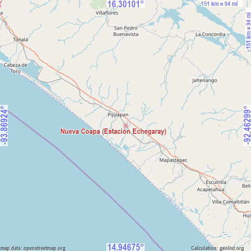
| Upper-left | 16.30101°, | -93.86924° |
| Center: | 15.625°, | -93.16611° |
| Lower-right: | 14.94675°, | -92.46299° |
| Map W x H: | 150.6×150.6 km | = 93.6×93.6mi |
| max Lat: | 32.7° ⇑98.3% North |
| Nueva Coapa (Estación Echegaray): | 15.625° |
| min Lat: | ⇓1.7% South 14.53588° |
| min Long | Nueva Coapa (Es | max Long |
| -117.105° | -93.16611° | -86.73105° |
| W 87.7%⇐ | ⇒12.3% E |
Elevation
Elevation of Nueva Coapa (Estación Echegaray) is 22 m = 72 ft, and this is 1231.7 m = 4041 ft below average elevation for this country.
| Max E: |
3497 m = 11473 ft | 90.8% |
| Avg. | 1253.7 m = 4113 ft | |
| Nueva Coapa (Estación Echegaray) | 22 m = 72 ft | |
Min E: |
-1 m = -3 ft | 9.2% |
See also: Mexico elevation on elevation.city.
Geographical zone
Nueva Coapa (Estación Echegaray) is located in North Torrid zone (between Equator and Tropic of Cancer). Distance of this Northern Tropic circle is 868.6 km =539.7 mi to North.| Distance of | km | miles | from Nueva Coapa (Estación Echegaray) |
|---|---|---|---|
| North Pole | 8269.7 | 5138.6 | to North |
| Arctic Circle | 5663.8 | 3519.3 | to North |
| Tropic Cancer | 868.6 | 539.7 | to North |
| Equator | 1737.3 | 1079.5 | to South |


Nearby cities:
15 places around Nueva Coapa (Estación Echegaray): (largest is in red/bold)
• Adolfo López Mateos
24.4 km =15.2 mi,  136°
136°
• Colonia Central
18.3 km =11.4 mi,  307°
307°
• El Carmen
6.8 km =4.2 mi, 143°
• El Palmarcito
15.1 km =9.4 mi,  199°
199°
• Guanajuato
2.7 km =1.7 mi,  24°
24°
• Hermenegildo Galeana
18.8 km =11.7 mi,  115°
115°
• Joaquín Miguel Gutiérrez (Margaritas)
11.4 km =7.1 mi, 136°
• La Esperanza
19.4 km =12.1 mi,  178°
178°
• La Esperanza (El Zapotal)
19.6 km =12.2 mi, 179°
• Las Brisas
13.1 km =8.1 mi,  156°
156°
• Miguel Alemán Valdez (Jericó)
18.4 km =11.4 mi, 120°
• Pijijiapan
8.2 km =5.1 mi,  325°
325°
• Plan de Ayala
14.4 km =8.9 mi,  74°
74°
• Progreso
3.6 km =2.2 mi, 142°
• San Isidro
23.9 km =14.9 mi,  303°
303°
Sources, notices
• [Note1] Compared only with cities in Mexico existing in our database
• [Src1] Map data: © OpenStreetMap contributors (CC-BY-SA)
• [Src2] Other city data from geonames.org with taken over terms of usage.
• [Src3] Geographical zone / Annual Mean Temperature by Robert A. Rohde @ Wikipedia
