San Martín Azcatepec geodata
San Martín Azcatepec (State of Mexico) is a populated place; located in Mexico in America/Mexico_City (GMT-6) time zone. With population of 35,390 people, there are 288 cities with bigger population in this country. Compared to other cities in Mexico, 50% of cities are located further ↓South; 50.6% of cities are located further ←West and 86.9% of cities have lower elevation than San Martín Azcatepec. Note1


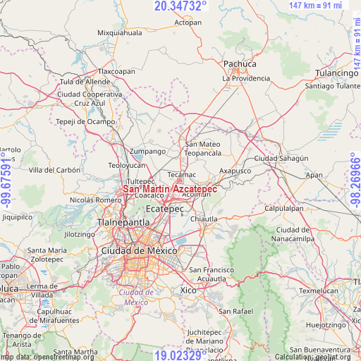
San Martín Azcatepec GPS coordinates[2]
19° 41' 12.012" North, 98° 58' 22.008" West
| Map corner | latitude | longitude |
|---|---|---|
| Upper-left | 20.34732°, | -99.67591° |
| Center: | 19.68667°, | -98.97278° |
| Lower-right: | 19.02329°, | -98.26966° |
| Map W x H: | 147.2×147.2 km | = 91.5×91.5mi |
| max Lat: | 32.7° ⇑50% North |
| San Martín Azcatepec: | 19.68667° |
| min Lat: | ⇓50% South 14.53588° |
| min Long | San Martín Azc | max Long |
| -117.105° | -98.97278° | -86.73105° |
| W 50.6%⇐ | ⇒49.4% E |
Elevation
Elevation of San Martín Azcatepec is 2308 m = 7572 ft, and this is 1054.3 m = 3459 ft above average elevation for this country.
| Max E: |
3497 m = 11473 ft | 13.1% |
| San Martín Azcatepec | 2308 m 7572 ft | |
| Avg. | 1253.7 m = 4113 ft | |
Min E: |
-1 m = -3 ft | 86.9% |
See also: Mexico elevation on elevation.city.
Geographical zone
San Martín Azcatepec is located in North Torrid zone (between Equator and Tropic of Cancer). Distance of this Northern Tropic circle is 417 km =259.1 mi to North.| Distance of | km | miles | from San Martín Azcatepec |
|---|---|---|---|
| North Pole | 7818.1 | 4857.9 | to North |
| Arctic Circle | 5212.2 | 3238.7 | to North |
| Tropic Cancer | 417 | 259.1 | to North |
| Equator | 2189 | 1360.2 | to South |


Nearby cities:
15 places around San Martín Azcatepec: (largest is in red/bold)
• Colonia Tezontla
2.7 km =1.7 mi,  230°
230°
• Ejido Atlatongo
7.5 km =4.7 mi,  101°
101°
• Fraccionamiento Hacienda del Bosque
4.5 km =2.8 mi,  5°
5°
• Ojo de Agua
4 km =2.5 mi,  259°
259°
• Prados de San Juan
5.2 km =3.2 mi,  182°
182°
• San Isidro del Progreso
6.6 km =4.1 mi,  67°
67°
• San José
7.3 km =4.5 mi,  114°
114°
• San Marcos Nepantla
4.7 km =2.9 mi, 114°
• San Pablo Tecalco
2.1 km =1.3 mi,  135°
135°
• Sanata Lucía
6.9 km =4.3 mi,  353°
353°
• Santa Catarina
7.4 km =4.6 mi, 138°
• Santiago Zacualuca
4.8 km =3 mi, 71°
• Santo Tomás Chiconautla
6.4 km =4 mi,  214°
214°
• Tecámac
2.9 km =1.8 mi, 7°
• Tecámac de Felipe Villanueva
3 km =1.9 mi, 9°
Sources, notices
• [Note1] Compared only with cities in Mexico existing in our database
• [Src1] Map data: © OpenStreetMap contributors (CC-BY-SA)
• [Src2] Other city data from geonames.org with taken over terms of usage.
• [Src3] Geographical zone / Annual Mean Temperature by Robert A. Rohde @ Wikipedia
