San Lorenzo Malacota geodata
San Lorenzo Malacota (State of Mexico) is a populated place; located in Mexico in America/Mexico_City (GMT-6) time zone. With population of 3,255 people, there are 2789 cities with bigger population in this country. Compared to other cities in Mexico, 50.9% of cities are located further ↑North; 58.8% of cities are located further →East and 96.5% of cities have lower elevation than San Lorenzo Malacota. Note1


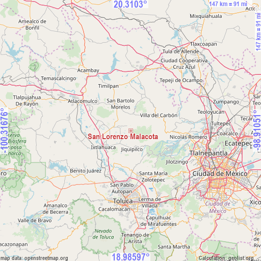
San Lorenzo Malacota GPS coordinates[2]
19° 38' 58.2" North, 99° 36' 49.068" West
| Map corner | latitude | longitude |
|---|---|---|
| Upper-left | 20.3103°, | -100.31676° |
| Center: | 19.6495°, | -99.61363° |
| Lower-right: | 18.98597°, | -98.91051° |
| Map W x H: | 147.3×147.3 km | = 91.5×91.5mi |
| max Lat: | 32.7° ⇑50.9% North |
| San Lorenzo Malacota: | 19.6495° |
| min Lat: | ⇓49.1% South 14.53588° |
| min Long | San Lorenzo Mal | max Long |
| -117.105° | -99.61363° | -86.73105° |
| W 41.2%⇐ | ⇒58.8% E |
Elevation
Elevation of San Lorenzo Malacota is 2651 m = 8698 ft, and this is 1397.3 m = 4584 ft above average elevation for this country.
| Max E: |
3497 m = 11473 ft | 3.5% |
| San Lorenzo Malacota | 2651 m 8698 ft | |
| Avg. | 1253.7 m = 4113 ft | |
Min E: |
-1 m = -3 ft | 96.5% |
See also: Mexico elevation on elevation.city.
Geographical zone
San Lorenzo Malacota is located in North Torrid zone (between Equator and Tropic of Cancer). Distance of this Northern Tropic circle is 421.1 km =261.7 mi to North.| Distance of | km | miles | from San Lorenzo Malacota |
|---|---|---|---|
| North Pole | 7822.2 | 4860.5 | to North |
| Arctic Circle | 5216.4 | 3241.3 | to North |
| Tropic Cancer | 421.1 | 261.7 | to North |
| Equator | 2184.8 | 1357.6 | to South |


Nearby cities:
15 places around San Lorenzo Malacota: (largest is in red/bold)
• Buenos Aires
6.7 km =4.2 mi,  237°
237°
• Colonia Emiliano Zapata
5.9 km =3.7 mi,  312°
312°
• Ejido Loma de Malacota
6.1 km =3.8 mi,  278°
278°
• Loma Hermosa
2.4 km =1.5 mi,  226°
226°
• Loma Hidalgo Colonia Benito Juárez
6.7 km =4.2 mi,  206°
206°
• Loma de Buenavista
1.4 km =0.9 mi,  176°
176°
• Manzana Tercera Loma de Hidalgo
7.9 km =4.9 mi, 213°
• Pueblo Nuevo
2.8 km =1.7 mi,  351°
351°
• Rancho Alegre
7.8 km =4.8 mi,  249°
249°
• San Antonio Nixini
8 km =5 mi,  290°
290°
• San Bartolo Oxtotitlán
3.4 km =2.1 mi, 179°
• San José del Sitio
7.6 km =4.7 mi, 226°
• Santa Clara de Juárez
7.8 km =4.8 mi,  5°
5°
• Santa María Nativitas
7.8 km =4.8 mi, 176°
• Tlalpujahuilla
2.1 km =1.3 mi, 284°
Sources, notices
• [Note1] Compared only with cities in Mexico existing in our database
• [Src1] Map data: © OpenStreetMap contributors (CC-BY-SA)
• [Src2] Other city data from geonames.org with taken over terms of usage.
• [Src3] Geographical zone / Annual Mean Temperature by Robert A. Rohde @ Wikipedia
