Loma Hermosa geodata
Loma Hermosa (State of Mexico) is a populated place; located in Mexico in America/Mexico_City (GMT-6) time zone. With population of 792 people, there are 11019 cities with bigger population in this country. Compared to other cities in Mexico, 51.2% of cities are located further ↑North; 59.1% of cities are located further →East and 96.9% of cities have lower elevation than Loma Hermosa. Note1


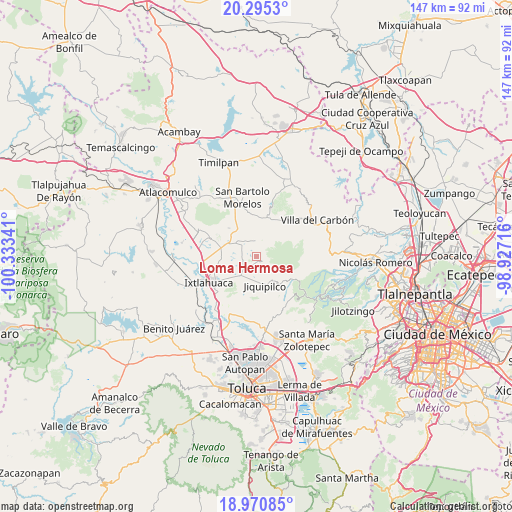
Loma Hermosa GPS coordinates[2]
19° 38' 3.984" North, 99° 37' 49.008" West
| Map corner | latitude | longitude |
|---|---|---|
| Upper-left | 20.2953°, | -100.33341° |
| Center: | 19.63444°, | -99.63028° |
| Lower-right: | 18.97085°, | -98.92716° |
| Map W x H: | 147.3×147.3 km | = 91.5×91.5mi |
| max Lat: | 32.7° ⇑51.2% North |
| Loma Hermosa: | 19.63444° |
| min Lat: | ⇓48.8% South 14.53588° |
| min Long | Loma Hermosa | max Long |
| -117.105° | -99.63028° | -86.73105° |
| W 40.9%⇐ | ⇒59.1% E |
Elevation
Elevation of Loma Hermosa is 2672 m = 8766 ft, and this is 1418.3 m = 4653 ft above average elevation for this country.
| Max E: |
3497 m = 11473 ft | 3.1% |
| Loma Hermosa | 2672 m 8766 ft | |
| Avg. | 1253.7 m = 4113 ft | |
Min E: |
-1 m = -3 ft | 96.9% |
See also: Mexico elevation on elevation.city.
Geographical zone
Loma Hermosa is located in North Torrid zone (between Equator and Tropic of Cancer). Distance of this Northern Tropic circle is 422.8 km =262.7 mi to North.| Distance of | km | miles | from Loma Hermosa |
|---|---|---|---|
| North Pole | 7823.9 | 4861.5 | to North |
| Arctic Circle | 5218 | 3242.3 | to North |
| Tropic Cancer | 422.8 | 262.7 | to North |
| Equator | 2183.1 | 1356.5 | to South |


Nearby cities:
15 places around Loma Hermosa: (largest is in red/bold)
• Buenos Aires
4.4 km =2.7 mi,  244°
244°
• Colonia Emiliano Zapata
6.3 km =3.9 mi,  335°
335°
• Ejido Loma de Malacota
5 km =3.1 mi,  300°
300°
• Loma Hidalgo Colonia Benito Juárez
4.5 km =2.8 mi,  196°
196°
• Loma Vicente Guerrero
6.2 km =3.9 mi, 202°
• Loma de Buenavista
1.9 km =1.2 mi,  81°
81°
• Loma de San Felipe
6.5 km =4 mi,  215°
215°
• Manzana Tercera Loma de Hidalgo
5.6 km =3.5 mi,  207°
207°
• Pueblo Nuevo
4.6 km =2.9 mi,  16°
16°
• Rancho Alegre
5.7 km =3.5 mi,  259°
259°
• San Bartolo Oxtotitlán
2.5 km =1.6 mi,  134°
134°
• San José del Sitio
5.2 km =3.2 mi,  226°
226°
• San Lorenzo Malacota
2.4 km =1.5 mi,  46°
46°
• Santa María Nativitas
6.5 km =4 mi,  160°
160°
• Tlalpujahuilla
2.2 km =1.4 mi,  352°
352°
Sources, notices
• [Note1] Compared only with cities in Mexico existing in our database
• [Src1] Map data: © OpenStreetMap contributors (CC-BY-SA)
• [Src2] Other city data from geonames.org with taken over terms of usage.
• [Src3] Geographical zone / Annual Mean Temperature by Robert A. Rohde @ Wikipedia
