Xkeulil geodata
Xkeulil (Campeche) is a populated place; located in Mexico in America/Merida (GMT-6) time zone. With population of 991 people, there are 8788 cities with bigger population in this country. Compared to other cities in Mexico, 51.3% of cities are located further ↑North; 97.1% of cities are located further ←West and 99.1% of cities have higher elevation than Xkeulil. Note1


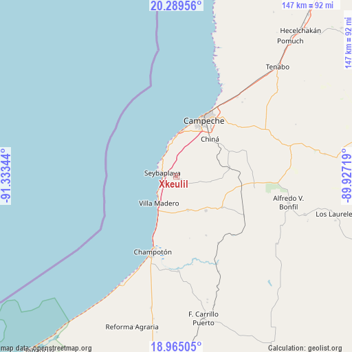
Xkeulil GPS coordinates[2]
19° 37' 43.212" North, 90° 37' 49.116" West
| Map corner | latitude | longitude |
|---|---|---|
| Upper-left | 20.28956°, | -91.33344° |
| Center: | 19.62867°, | -90.63031° |
| Lower-right: | 18.96505°, | -89.92719° |
| Map W x H: | 147.3×147.3 km | = 91.5×91.5mi |
| max Lat: | 32.7° ⇑51.3% North |
| Xkeulil: | 19.62867° |
| min Lat: | ⇓48.7% South 14.53588° |
| min Long | Xkeulil | max Long |
| -117.105° | -90.63031° | -86.73105° |
| W 97.1%⇐ | ⇒2.9% E |
Elevation
Elevation of Xkeulil is 6 m = 20 ft, and this is 1247.7 m = 4094 ft below average elevation for this country.
| Max E: |
3497 m = 11473 ft | 99.1% |
| Avg. | 1253.7 m = 4113 ft | |
| Xkeulil | 6 m = 20 ft | |
Min E: |
-1 m = -3 ft | 0.9% |
See also: Mexico elevation on elevation.city.
Geographical zone
Xkeulil is located in North Torrid zone (between Equator and Tropic of Cancer). Distance of this Northern Tropic circle is 423.4 km =263.1 mi to North.| Distance of | km | miles | from Xkeulil |
|---|---|---|---|
| North Pole | 7824.6 | 4862 | to North |
| Arctic Circle | 5218.7 | 3242.7 | to North |
| Tropic Cancer | 423.4 | 263.1 | to North |
| Equator | 2182.5 | 1356.1 | to South |


Nearby cities:
15 places around Xkeulil: (largest is in red/bold)
• Campeche
26.3 km =16.3 mi,  24°
24°
• Castamay
31.2 km =19.4 mi,  41°
41°
• Champotón
32.7 km =20.3 mi,  196°
196°
• Chiná
21.1 km =13.1 mi, 41°
• Ciudad del Sol
18.4 km =11.4 mi, 204°
• Hool
23.2 km =14.4 mi,  123°
123°
• La Joya
17.1 km =10.6 mi, 195°
• Lerma
19.7 km =12.2 mi,  8°
8°
• Moquel
31 km =19.3 mi,  188°
188°
• Nohakal
31 km =19.3 mi,  84°
84°
• Pocyaxum
31.3 km =19.4 mi,  69°
69°
• Santo Domingo Kesté
19 km =11.8 mi,  139°
139°
• Seybaplaya
6.1 km =3.8 mi,  281°
281°
• Sihochac
15 km =9.3 mi,  161°
161°
• Villa Madero
13.3 km =8.3 mi,  212°
212°
Sources, notices
• [Note1] Compared only with cities in Mexico existing in our database
• [Src1] Map data: © OpenStreetMap contributors (CC-BY-SA)
• [Src2] Other city data from geonames.org with taken over terms of usage.
• [Src3] Geographical zone / Annual Mean Temperature by Robert A. Rohde @ Wikipedia
