Nueva Chontalpa geodata
Nueva Chontalpa (Campeche) is a populated place; located in Mexico in America/Merida (GMT-6) time zone. With population of 647 people, there are 13375 cities with bigger population in this country. Compared to other cities in Mexico, 72.9% of cities are located further ↑North; 96.7% of cities are located further ←West and 88.6% of cities have higher elevation than Nueva Chontalpa. Note1


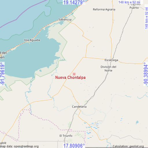
Nueva Chontalpa GPS coordinates[2]
18° 28' 37.992" North, 91° 5' 35.016" West
| Map corner | latitude | longitude |
|---|---|---|
| Upper-left | 19.14279°, | -91.79619° |
| Center: | 18.47722°, | -91.09306° |
| Lower-right: | 17.80906°, | -90.38994° |
| Map W x H: | 148.3×148.3 km | = 92.1×92.1mi |
| max Lat: | 32.7° ⇑72.9% North |
| Nueva Chontalpa: | 18.47722° |
| min Lat: | ⇓27.1% South 14.53588° |
| min Long | Nueva Chontalpa | max Long |
| -117.105° | -91.09306° | -86.73105° |
| W 96.7%⇐ | ⇒3.3% E |
Elevation
Elevation of Nueva Chontalpa is 28 m = 92 ft, and this is 1225.7 m = 4021 ft below average elevation for this country.
| Max E: |
3497 m = 11473 ft | 88.6% |
| Avg. | 1253.7 m = 4113 ft | |
| Nueva Chontalpa | 28 m = 92 ft | |
Min E: |
-1 m = -3 ft | 11.4% |
See also: Mexico elevation on elevation.city.
Geographical zone
Nueva Chontalpa is located in North Torrid zone (between Equator and Tropic of Cancer). Distance of this Northern Tropic circle is 551.4 km =342.6 mi to North.| Distance of | km | miles | from Nueva Chontalpa |
|---|---|---|---|
| North Pole | 7952.6 | 4941.5 | to North |
| Arctic Circle | 5346.7 | 3322.3 | to North |
| Tropic Cancer | 551.4 | 342.6 | to North |
| Equator | 2054.5 | 1276.6 | to South |


Nearby cities:
15 places around Nueva Chontalpa: (largest is in red/bold)
• Benito Juárez Uno
22.3 km =13.9 mi,  181°
181°
• Candelaria
32.8 km =20.4 mi,  171°
171°
• Don Samuel
28.1 km =17.5 mi,  117°
117°
• General Francisco J. Mújica
28.3 km =17.6 mi, 173°
• Haro
32 km =19.9 mi,  96°
96°
• La Cristalina
28.3 km =17.6 mi,  8°
8°
• La Victoria
17.8 km =11.1 mi,  85°
85°
• Licenciado Gustavo Díaz Ordaz (18 de Marzo)
19.7 km =12.2 mi,  28°
28°
• Luna
28.6 km =17.8 mi,  134°
134°
• Mamantel
5.3 km =3.3 mi,  4°
4°
• Miguel Alemán
30.1 km =18.7 mi,  150°
150°
• Nuevo Progreso Dos
24.6 km =15.3 mi,  49°
49°
• Pejelagarto
33.6 km =20.9 mi,  162°
162°
• Pital Nuevo
14.9 km =9.3 mi, 25°
• San Isidro
18 km =11.2 mi, 14°
Sources, notices
• [Note1] Compared only with cities in Mexico existing in our database
• [Src1] Map data: © OpenStreetMap contributors (CC-BY-SA)
• [Src2] Other city data from geonames.org with taken over terms of usage.
• [Src3] Geographical zone / Annual Mean Temperature by Robert A. Rohde @ Wikipedia
