Candelaria geodata
Candelaria (Campeche) is a seat of a second-order administrative division; located in Mexico in America/Merida (GMT-6) time zone. With population of 9,812 people, there are 976 cities with bigger population in this country. Compared to other cities in Mexico, 76.4% of cities are located further ↑North; 96.8% of cities are located further ←West and 90% of cities have higher elevation than Candelaria. Note1


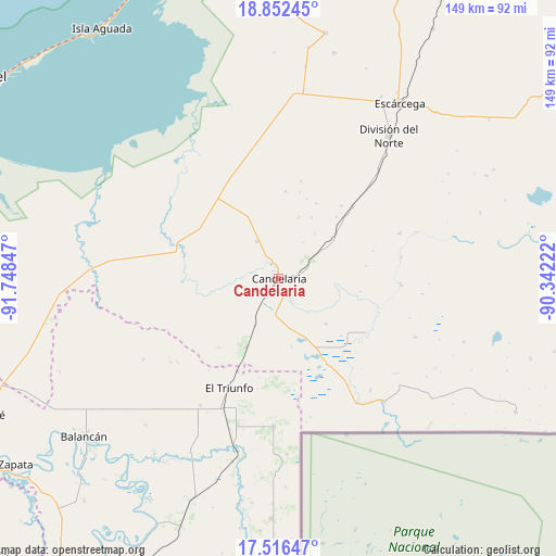
Candelaria GPS coordinates[2]
18° 11' 8.664" North, 91° 2' 43.224" West
| Map corner | latitude | longitude |
|---|---|---|
| Upper-left | 18.85245°, | -91.74847° |
| Center: | 18.18574°, | -91.04534° |
| Lower-right: | 17.51647°, | -90.34222° |
| Map W x H: | 148.5×148.5 km | = 92.3×92.3mi |
| max Lat: | 32.7° ⇑76.4% North |
| Candelaria: | 18.18574° |
| min Lat: | ⇓23.6% South 14.53588° |
| min Long | Candelaria | max Long |
| -117.105° | -91.04534° | -86.73105° |
| W 96.8%⇐ | ⇒3.2% E |
Elevation
Elevation of Candelaria is 24 m = 79 ft, and this is 1229.7 m = 4034 ft below average elevation for this country.
| Max E: |
3497 m = 11473 ft | 90% |
| Avg. | 1253.7 m = 4113 ft | |
| Candelaria | 24 m = 79 ft | |
Min E: |
-1 m = -3 ft | 10% |
See also: Mexico elevation on elevation.city.
Geographical zone
Candelaria is located in North Torrid zone (between Equator and Tropic of Cancer). Distance of this Northern Tropic circle is 583.9 km =362.8 mi to North.| Distance of | km | miles | from Candelaria |
|---|---|---|---|
| North Pole | 7985 | 4961.6 | to North |
| Arctic Circle | 5379.1 | 3342.4 | to North |
| Tropic Cancer | 583.9 | 362.8 | to North |
| Equator | 2022.1 | 1256.5 | to South |


Nearby cities:
15 places around Candelaria: (largest is in red/bold)
• Benito Juárez Uno
11.6 km =7.2 mi,  330°
330°
• Conquista Campesina
25.6 km =15.9 mi,  268°
268°
• Don Samuel
27.7 km =17.2 mi,  45°
45°
• El Naranjo
20.1 km =12.5 mi,  205°
205°
• El Pichi
30 km =18.6 mi,  174°
174°
• El Triunfo
32.1 km =19.9 mi,  204°
204°
• General Francisco J. Mújica
4.6 km =2.9 mi,  338°
338°
• Luna
19.6 km =12.2 mi, 51°
• Miguel Alemán
11.5 km =7.1 mi,  57°
57°
• Nueva Chontalpa
32.8 km =20.4 mi,  351°
351°
• Nueva Rosita
34.5 km =21.4 mi,  69°
69°
• Ojo de Agua
35.3 km =21.9 mi,  194°
194°
• Pablo García
17.4 km =10.8 mi,  133°
133°
• Pejelagarto
5 km =3.1 mi,  85°
85°
• Venustiano Carranza
4.6 km =2.9 mi,  158°
158°
Sources, notices
• [Note1] Compared only with cities in Mexico existing in our database
• [Src1] Map data: © OpenStreetMap contributors (CC-BY-SA)
• [Src2] Other city data from geonames.org with taken over terms of usage.
• [Src3] Geographical zone / Annual Mean Temperature by Robert A. Rohde @ Wikipedia
