Ahuehuepan geodata
Ahuehuepan (Guerrero) is a populated place; located in Mexico in America/Mexico_City (GMT-6) time zone. With population of 596 people, there are 14429 cities with bigger population in this country. Compared to other cities in Mexico, 74.4% of cities are located further ↑North; 59.5% of cities are located further →East and 64.1% of cities have higher elevation than Ahuehuepan. Note1


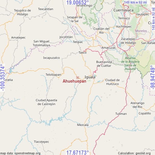
Ahuehuepan GPS coordinates[2]
18° 20' 25.476" North, 99° 39' 2.196" West
| Map corner | latitude | longitude |
|---|---|---|
| Upper-left | 19.00652°, | -100.35374° |
| Center: | 18.34041°, | -99.65061° |
| Lower-right: | 17.67173°, | -98.94749° |
| Map W x H: | 148.4×148.4 km | = 92.2×92.2mi |
| max Lat: | 32.7° ⇑74.4% North |
| Ahuehuepan: | 18.34041° |
| min Lat: | ⇓25.6% South 14.53588° |
| min Long | Ahuehuepan | max Long |
| -117.105° | -99.65061° | -86.73105° |
| W 40.5%⇐ | ⇒59.5% E |
Elevation
Elevation of Ahuehuepan is 748 m = 2454 ft, and this is 505.7 m = 1659 ft below average elevation for this country.
| Max E: |
3497 m = 11473 ft | 64.1% |
| Avg. | 1253.7 m = 4113 ft | |
| Ahuehuepan | 748 m = 2454 ft | |
Min E: |
-1 m = -3 ft | 35.9% |
See also: Mexico elevation on elevation.city.
Geographical zone
Ahuehuepan is located in North Torrid zone (between Equator and Tropic of Cancer). Distance of this Northern Tropic circle is 566.7 km =352.1 mi to North.| Distance of | km | miles | from Ahuehuepan |
|---|---|---|---|
| North Pole | 7967.8 | 4951 | to North |
| Arctic Circle | 5361.9 | 3331.7 | to North |
| Tropic Cancer | 566.7 | 352.1 | to North |
| Equator | 2039.3 | 1267.2 | to South |


Nearby cities:
15 places around Ahuehuepan: (largest is in red/bold)
• Apango
12.1 km =7.5 mi,  194°
194°
• Ceja Blanca
10.7 km =6.6 mi,  118°
118°
• Chilacachapa
13.9 km =8.6 mi,  237°
237°
• Coatepec Costales
7.5 km =4.7 mi,  268°
268°
• Cocula
11.1 km =6.9 mi, 186°
• Colonia 15 de Septiembre
14 km =8.7 mi,  72°
72°
• El Naranjo
13.9 km =8.6 mi,  61°
61°
• Fermín Rabadán Cervantes
9.2 km =5.7 mi,  107°
107°
• Huixtac
13.5 km =8.4 mi,  356°
356°
• Iguala de la Independencia
11.5 km =7.1 mi,  87°
87°
• Metlapa
5.5 km =3.4 mi,  127°
127°
• Puente Campuzano
13.9 km =8.6 mi,  28°
28°
• Temaxcalapa
9.6 km =6 mi,  346°
346°
• Tlacuitlapa
6.1 km =3.8 mi,  257°
257°
• Tonalapa del Río
4.3 km =2.7 mi, 272°
Sources, notices
• [Note1] Compared only with cities in Mexico existing in our database
• [Src1] Map data: © OpenStreetMap contributors (CC-BY-SA)
• [Src2] Other city data from geonames.org with taken over terms of usage.
• [Src3] Geographical zone / Annual Mean Temperature by Robert A. Rohde @ Wikipedia
