Mexcaltepec geodata
Mexcaltepec (Guerrero) is a populated place; located in Mexico in America/Mexico_City (GMT-6) time zone. With population of 588 people, there are 14598 cities with bigger population in this country. Compared to other cities in Mexico, 73.5% of cities are located further ↑North; 57.5% of cities are located further →East and 61.2% of cities have higher elevation than Mexcaltepec. Note1


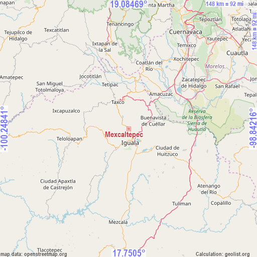
Mexcaltepec GPS coordinates[2]
18° 25' 8.004" North, 99° 32' 43.008" West
| Map corner | latitude | longitude |
|---|---|---|
| Upper-left | 19.08469°, | -100.24841° |
| Center: | 18.41889°, | -99.54528° |
| Lower-right: | 17.7505°, | -98.84216° |
| Map W x H: | 148.3×148.3 km | = 92.1×92.1mi |
| max Lat: | 32.7° ⇑73.5% North |
| Mexcaltepec: | 18.41889° |
| min Lat: | ⇓26.5% South 14.53588° |
| min Long | Mexcaltepec | max Long |
| -117.105° | -99.54528° | -86.73105° |
| W 42.5%⇐ | ⇒57.5% E |
Elevation
Elevation of Mexcaltepec is 923 m = 3028 ft, and this is 330.7 m = 1085 ft below average elevation for this country.
| Max E: |
3497 m = 11473 ft | 61.2% |
| Avg. | 1253.7 m = 4113 ft | |
| Mexcaltepec | 923 m = 3028 ft | |
Min E: |
-1 m = -3 ft | 38.8% |
See also: Mexico elevation on elevation.city.
Geographical zone
Mexcaltepec is located in North Torrid zone (between Equator and Tropic of Cancer). Distance of this Northern Tropic circle is 557.9 km =346.7 mi to North.| Distance of | km | miles | from Mexcaltepec |
|---|---|---|---|
| North Pole | 7959.1 | 4945.6 | to North |
| Arctic Circle | 5353.2 | 3326.3 | to North |
| Tropic Cancer | 557.9 | 346.7 | to North |
| Equator | 2048 | 1272.6 | to South |


Nearby cities:
15 places around Mexcaltepec: (largest is in red/bold)
• Colonia 15 de Septiembre
5 km =3.1 mi,  153°
153°
• Colonia Francisco Villa
4.8 km =3 mi, 150°
• Coxcatlán
12.4 km =7.7 mi,  46°
46°
• Dolores
13 km =8.1 mi,  325°
325°
• El Ejido (Ejido Guerrero)
11.3 km =7 mi, 326°
• El Naranjo
2.4 km =1.5 mi, 152°
• Fermín Rabadán Cervantes
11.8 km =7.3 mi,  191°
191°
• Huixtac
12.9 km =8 mi,  291°
291°
• Iguala de la Independencia
8.2 km =5.1 mi,  177°
177°
• Puente Campuzano
5.7 km =3.5 mi,  307°
307°
• Santiago Temixco
12.5 km =7.8 mi, 305°
• Taxco el Viejo
8.3 km =5.2 mi, 330°
• Tecalpulco
9.8 km =6.1 mi,  321°
321°
• Tlamacazapa
9.8 km =6.1 mi,  28°
28°
• Tuxpan
10.4 km =6.5 mi,  138°
138°
Sources, notices
• [Note1] Compared only with cities in Mexico existing in our database
• [Src1] Map data: © OpenStreetMap contributors (CC-BY-SA)
• [Src2] Other city data from geonames.org with taken over terms of usage.
• [Src3] Geographical zone / Annual Mean Temperature by Robert A. Rohde @ Wikipedia
